Public Policy in India: Meaning, Types, Process, Importance and Challenges
Longest Rivers in India: Complete List, Length, Map & RAS Exam Notes (2026)

Get in Touch with RASonly!

The longest rivers in India have shaped the country's history, agriculture, and culture for thousands of years, long before borders or states existed. From the Ganga winding lazily across the northern plains to the Godavari rushing down the Deccan Plateau, each river tells a different story about the land it flows through. This guide breaks down the complete list of India's longest rivers, their length, source, and significance - along with a dedicated section for RAS exam aspirants on the rivers of Rajasthan.

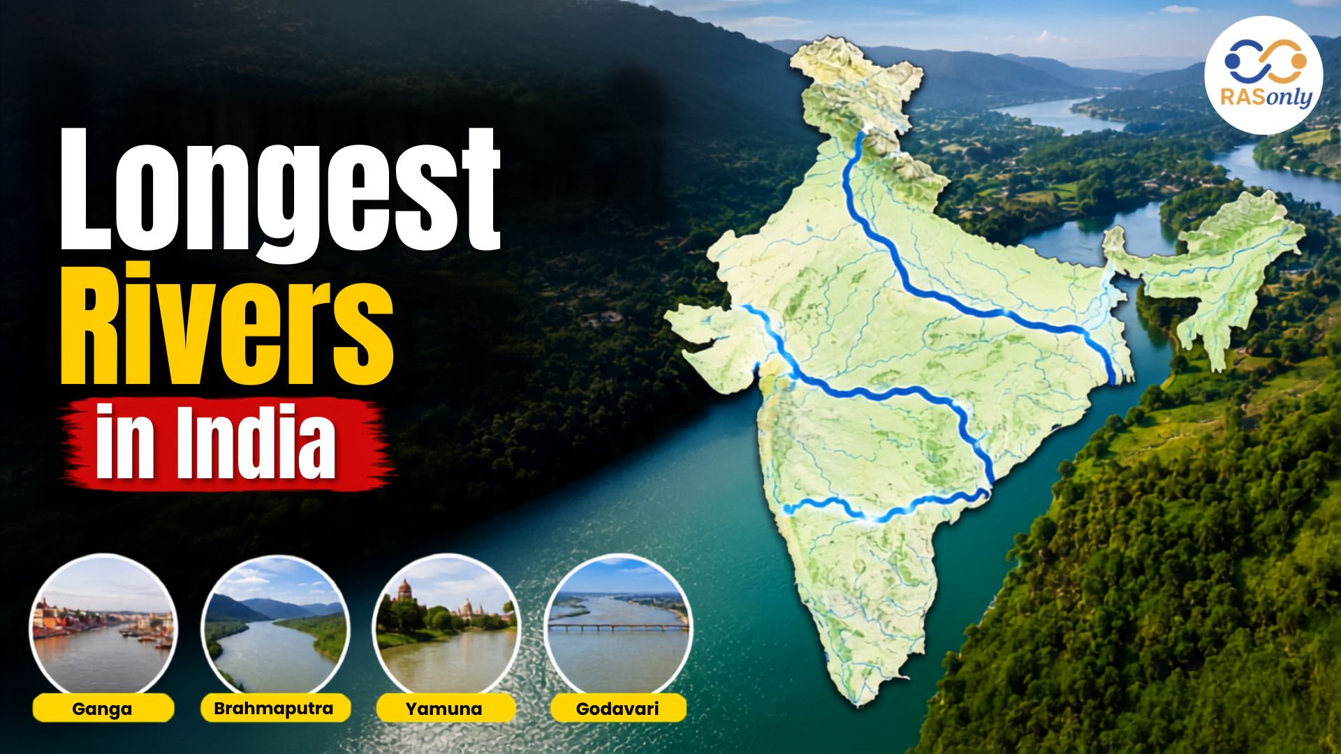
If you have ever traced a river on a map of India, you know how differently they behave. Some, like the Ganga, are lazy giants that wind across the entire northern plain before finally giving up their water to the sea. Others, like the rivers of the peninsula, rush down from the hills in a hurry, swelling in the monsoon and shrinking to a trickle by summer. Understanding the longest rivers in India is not just useful trivia - it explains why certain cities grew where they did, why some states fight over water sharing even today, and why this remains one of the most repeated topics in RAS, UPSC, and state-level competitive exams.
This guide covers the complete list of the longest rivers in India, their source and length, how Himalayan and Peninsular rivers differ, and a dedicated section for RAS aspirants on the rivers of Rajasthan.
Why Measuring a River's Length Isn't as Simple as It Sounds
Before jumping into the list, it's worth pausing on something most articles skip: river length figures are not fixed numbers agreed upon by everyone. Length depends on where you consider the river's "true source" - the farthest tributary, or the point after which the river carries a single recognized name? It also depends on whether you're measuring the river's full course (including the part outside India) or only the stretch within Indian territory.
This is why you'll sometimes see the Ganga's length quoted as 2,525 km and elsewhere as 2,600 km, or the Brahmaputra listed at 2,900 km in some sources and under 3,000 km in others. For this article, we've used the commonly accepted figures used in Indian geography textbooks and exam study material, since consistency matters more than chasing the "most precise" number when you're preparing for an exam.
Complete List of the Longest Rivers in India
| Rank | River | Length (Approx. km) | Source | Outflow | Major States Covered |
|---|---|---|---|---|---|
| 1 | Ganga | 2,525 km | Gangotri Glacier, Uttarakhand | Bay of Bengal (via Bangladesh) | Uttarakhand, Uttar Pradesh, Bihar, Jharkhand, West Bengal |
| 2 | Godavari | 1,465 km | Trimbakeshwar, Nashik (Maharashtra) | Bay of Bengal | Maharashtra, Telangana, Andhra Pradesh, Chhattisgarh, Odisha |
| 3 | Krishna | 1,400 km | Mahabaleshwar, Maharashtra | Bay of Bengal | Maharashtra, Karnataka, Telangana, Andhra Pradesh |
| 4 | Yamuna | 1,376 km | Yamunotri Glacier, Uttarakhand | Merges into Ganga at Prayagraj | Uttarakhand, Himachal Pradesh, Haryana, Delhi, Uttar Pradesh |
| 5 | Narmada | 1,312 km | Amarkantak, Madhya Pradesh | Arabian Sea | Madhya Pradesh, Maharashtra, Gujarat |
| 6 | Indus (India Stretch) | ~1,114 km | Tibetan Plateau (near Mansarovar) | Arabian Sea (via Pakistan) | Ladakh, Jammu & Kashmir, Punjab |
| 7 | Brahmaputra (India Stretch) | ~916 km | Angsi Glacier, Tibet | Bay of Bengal (via Bangladesh) | Arunachal Pradesh, Assam |
| 8 | Mahanadi | 858 km | Sihawa, Chhattisgarh | Bay of Bengal | Chhattisgarh, Odisha |
| 9 | Kaveri (Cauvery) | 800 km | Talakaveri, Karnataka | Bay of Bengal | Karnataka, Tamil Nadu |
| 10 | Tapti (Tapi) | 724 km | Multai, Madhya Pradesh | Arabian Sea | Madhya Pradesh, Maharashtra, Gujarat |
Paragraph-wise, a few things stand out from this table. First, notice that four of the top five rivers by length - Ganga, Yamuna, Narmada, and even the Indus - originate in or near the Himalayan region, which tells you a lot about why northern India has historically been so agriculturally rich. Second, only two rivers in this list - Narmada and Tapti - flow westward into the Arabian Sea; almost every other major Indian river empties into the Bay of Bengal. This single fact is asked repeatedly in exams, so it's worth remembering on its own.
The Ganga: India's Longest and Most Significant River
The Ganga is not just the longest river within India - it is arguably the country's most culturally significant one. It originates at the Gangotri Glacier in Uttarakhand as the Bhagirathi and only takes the name "Ganga" after merging with the Alaknanda at Devprayag. From there, it flows through Uttarakhand, Uttar Pradesh, Bihar, Jharkhand, and West Bengal, passing through cities like Haridwar, Prayagraj, Varanasi, and Kolkata before entering Bangladesh and finally the Bay of Bengal.
The Ganga basin supports an enormous share of India's population and agriculture, which is why the river is often described as the lifeline of the northern plains. It's also one of the most polluted major rivers in the world, and government programs like the Namami Gange Mission have been running for years specifically to address this.
Godavari: The "Dakshin Ganga" of Peninsular India
South of the Vindhyas, the Godavari plays the role the Ganga plays in the north - it's the longest and most important river of the entire Deccan Plateau, which is why it earned the nickname Dakshin Ganga, or "Ganga of the South." It rises near Trimbakeshwar in Maharashtra's Nashik district and travels across five states before reaching the Bay of Bengal, forming a large and fertile delta near its mouth in Andhra Pradesh.
Krishna, Yamuna, and Narmada: The Next Tier
- Krishna River - Also originating in Maharashtra, near Mahabaleshwar, the Krishna is the second-longest river of Peninsular India after the Godavari. It's a crucial water source for Karnataka, Telangana, and Andhra Pradesh and has been at the center of several interstate water disputes.
- Yamuna River - Technically the largest tributary of the Ganga rather than an independent river system, the Yamuna still makes this list because of its sheer length and cultural importance. It flows past Delhi and Agra before merging with the Ganga at the Sangam in Prayagraj.
- Narmada River - One of only two major westward-flowing rivers in India, the Narmada cuts across the Vindhya and Satpura ranges before draining into the Arabian Sea near Bharuch, Gujarat. It forms a distinct rift valley, unlike most peninsular rivers that flow along the natural slope of the land.
Himalayan Rivers vs Peninsular Rivers: What's the Real Difference?
This distinction comes up in almost every exam question about Indian rivers, so it deserves its own clear breakdown rather than a passing mention.
| Feature | Himalayan Rivers | Peninsular Rivers |
|---|---|---|
| Source | Glaciers and snowfields of the Himalayas | Hills and plateaus of Peninsular India (Western Ghats, Central Highlands) |
| Water Flow | Perennial – Flows year-round, fed by snowmelt and rainfall | Seasonal – Heavily dependent on monsoon rainfall |
| Examples | Ganga, Yamuna, Brahmaputra, Indus | Godavari, Krishna, Kaveri, Narmada, Tapti |
| Course | Long, winding course through plains | Comparatively shorter, faster-flowing course |
| Valleys | Form deep gorges and V-shaped valleys in mountains, then broad plains | Flow through shallow valleys on relatively stable, ancient plateau rock |
| Delta Formation | Form large, fertile deltas (e.g., Sundarbans) | Also form deltas, but generally smaller (except Godavari and Krishna deltas) |
In simple terms: if a river is fed by melting snow, it rarely runs dry, no matter how brutal the summer is. That's the Himalayan advantage. Peninsular rivers, on the other hand, are entirely at the mercy of the monsoon - which is exactly why droughts hit central and southern India harder during weak monsoon years.
Why These Rivers Matter Beyond Geography
It's easy to treat river length as a purely academic fact, but these rivers shape real economic and political decisions even today:
- Irrigation and agriculture - The Ganga and Godavari basins alone support hundreds of millions of farmers.
- Hydropower - Rivers like the Narmada (Sardar Sarovar Dam) and Krishna are central to India's hydroelectric capacity.
- Inter-state disputes - The Krishna, Kaveri, and Narmada waters have all been subjects of long-running tribunal disputes between states.
- Urban water supply - Cities like Delhi (Yamuna), Kolkata (Hooghly, a Ganga distributary), and Hyderabad (Krishna via canals) depend directly on these rivers.
- Religious and cultural identity - The Ganga, Yamuna, and Kaveri are considered sacred, and pilgrimage towns have grown along their banks for centuries.
Rivers of Rajasthan: What RAS Aspirants Must Know
Since this topic is directly relevant for the RAS exam, it's worth going a level deeper into Rajasthan's own river systems, which get tested separately from the national-level river questions.
Rajasthan's rivers are generally shorter and more seasonal than the national giants, largely because much of the state falls in an arid or semi-arid zone. Even so, this is one of the highest-yield topics in RAS Prelims Geography.
| River | Basin/Region | Key Facts |
|---|---|---|
| Chambal | Chambal Basin | Longest river of Rajasthan; a major tributary of the Yamuna; known for ravines and the Kota Barrage. |
| Banas | Banas Basin | Originates near Kumbhalgarh and is a major tributary of the Chambal River. |
| Luni | Luni Basin | The only significant west-flowing river of Rajasthan; drains into the Rann of Kutch and becomes saline in its lower course. |
| Mahi | Mahi Basin | Flows through southern Rajasthan into Gujarat; important for the Mahi Bajaj Sagar Dam. |
| Sabarmati | Sabarmati Basin | Originates in the Aravalli Hills and flows into Gujarat before emptying into the Arabian Sea. |
| Kali Sindh | Chambal Basin (Tributary) | A tributary of the Chambal River that flows through Jhalawar and Kota districts. |
A quick but important fact for revision: large parts of northwestern Rajasthan (the Thar Desert region) fall under the inland/endorheic drainage system, meaning rivers there don't reach the sea at all - they either dry up, feed into salt lakes like Sambhar Lake, or disappear into the desert sands.
Environmental Concerns Facing India's Rivers
No modern discussion of Indian rivers is complete without acknowledging the environmental pressure they're under. It's not just one problem either, it's a mix of pollution, over-extraction, and poor planning that's been building up for decades, and different rivers are struggling with different versions of the same story.
| Concern | Main Causes | Worst-Affected Rivers | Impact | Government/Conservation Response |
|---|---|---|---|---|
| Industrial & Sewage Pollution | Untreated industrial effluents and domestic sewage discharged directly into rivers | Ganga, Yamuna, Sabarmati | Rising toxicity, unsafe drinking water, harm to aquatic life | Namami Gange Mission, Yamuna Action Plan, Sewage Treatment Plants (STPs) |
| Over-Extraction for Irrigation | Excessive canal withdrawal for agriculture, especially during dry months | Kaveri, Krishna, Godavari | Reduced downstream flow, inter-state water disputes | River water tribunals (e.g., Cauvery Water Disputes Tribunal) |
| Excessive Damming | Large dams built for irrigation and hydropower, disrupting natural flow | Narmada, Krishna, Sutlej | Altered sediment flow, submergence of forests and villages, displacement of communities | Environmental Impact Assessments (EIAs), rehabilitation policies |
| Encroachment & Urban Runoff | Construction on floodplains, plastic and solid waste dumping | Yamuna (Delhi stretch), Hooghly | Reduced water absorption, increased flood risk, visible plastic pollution | Floodplain zoning laws, riverfront development projects |
| Groundwater–River Depletion | Excessive borewell extraction lowering the water table that feeds rivers | Luni, smaller Rajasthan rivers | Rivers running dry or turning seasonal even where they were once perennial | Atal Bhujal Yojana, rainwater harvesting initiatives |
| Climate Change & Glacial Melt | Irregular monsoon patterns, faster Himalayan glacier retreat | Ganga, Brahmaputra, Indus | Unpredictable flooding in some seasons, water scarcity in others | National Action Plan on Climate Change (NAPCC), glacier monitoring programs |
What stands out when you lay it out this way is that no single river is fighting just one battle. The Ganga, for instance, deals with sewage pollution and climate-driven glacial changes at the same time, while the Yamuna's stretch through Delhi is choked by both industrial waste and unchecked construction on its floodplain. Rajasthan's smaller rivers face a quieter but equally serious crisis - groundwater depletion is drying them up long before pollution even becomes the main issue.
Important Links
Conclusion
India's rivers are far more than lines on a map - they're the reason ancient cities were founded where they were, the reason certain states still negotiate water-sharing agreements today, and a topic that shows up again and again in RAS and other competitive exams. Knowing the basics - length, source, direction of flow, and the states each river touches - will cover the vast majority of questions asked. For RAS specifically, don't stop at the national list; make sure the Chambal, Banas, Luni, and Mahi are just as familiar to you as the Ganga and Godavari.
Frequently Asked Questions
The Ganga is the longest river flowing entirely within India, at approximately 2,525 km.
The Godavari, often called the Dakshin Ganga, is the longest river of Peninsular India at about 1,465 km.
The Chambal River is the longest river in Rajasthan and a major tributary of the Yamuna.
The Brahmaputra's total length (around 2,900 km) is longer than the Ganga's overall, but only about 916 km of it flows within India - whereas the Ganga runs almost entirely through Indian territory.
Only two major rivers, the Narmada and the Tapti, flow westward. In Rajasthan, the Luni is the state's only significant west-flowing river.

BEST SELLER
🏆 PRELIMS
RAS Pass
Prelims focused Hindi & English
₹399
✓
Prelims Topic-Wise Tests
✓
Subject-Wise Tests
✓
Full-Length Prelims Tests
✓
Daily Current Affairs Tests
✓
Prelims PYQs Tests
✓
Detailed Solutions & Analysis
✓
All Rajasthan Ranking
✓
Unlimited Reattempts
✓
Mains Tests
✓
Hindi & English Tests
✓
All Rajasthan Ranking
Trusted by 5,000+ Students
Post Category
- RAS Salary
- Result
- RAS Admit Card
- RAS Job
- RAS Cutoff
- Preparation Tips
- RAS Answer Key
- RAS Exam Analysis
- RAS Syllabus
- RAS Previous Year Papers
- RPSC RAS Exam Pattern
- RAS Interview
- RAS Exam Date
- RAS Vacancy
- RAS Test Series
- RAS Best Books
- RAS Preparation Resources
- RAS Coaching Centre
- History
- Polity
- Geography
- Economics
- Science
- Art and Culture
- RPSC RAS Application Form
- RPSC RAS Notification
- RAS Eligibility Criteria
- UPSC Exam
- RPSC RAS Mains
Visit Our RASonly Offline Center
Our Expert Faculty

Bhunesh Sir
Current Affairs · 13+ Yrs

Aamir Khan Sir
RAS-2017 · IIM Ahm.
Akash Sir
Polity · 8+ Yrs
Free Resources
Official Mobile App

RASOnly App
by OTSAdda · Free
Full Video Lectures
Mock Tests & PYQs
Daily Current Affairs
AI Mock Interview
Free Download · No subscription needed to install
RAS 2024 Toppers — RASonly
Rank 2
Virendra Charan
Rank 9
Bhoopinder Singh
Rank 26
Aanchal Nagpal
Rank 33
Lokendra Singh
Rank 45
Amar Rathore
Rank 46
Manasvini Verma

Join RASonly WhatsApp Community
Get daily current affairs, exam alerts, free study material and tips from expert faculty — right on WhatsApp.
Join for Free →RASonly Interview Guidance Program

Mr. Ashok Jain
Ex-Chief Secretary Govt of Rajasthan
- IAS officer of the 1981 batch, Rajasthan cadre.
- Passionate about mentoring the next generation of RAS officers with real-world insights.
- Got retired in Dec 2017 from the post of Chief Secretary of the state of Rajasthan.

Mr. Guru Charan Rai
Ex-ASP / SP in Jaisalmer
- Guru Charan Rai, IPS (Retd), retired as Inspector General of Police (Security), Rajasthan, Jaipur in 2017.
- Served as ASP and SP in Jaisalmer, Nagaur, Sri Ganganagar, Sawai Madhopur, Dausa, Sikar, and Karauli.
- He also held key positions as DIGP and IGP in the Law and Order division.

Mr. Rakesh Verma
Ex-IAS Officer, B.Tech, MBA, and M.A. (Economics)
- IAS officer of the 1981 batch and retired in Chief Secretary Rank.
- Civil servant of high repute and vast experience.
- Has been teaching UPSC CSE subjects for the last six years.
Related Post

Daily Current Affairs for RAS Exam Preparation 2026
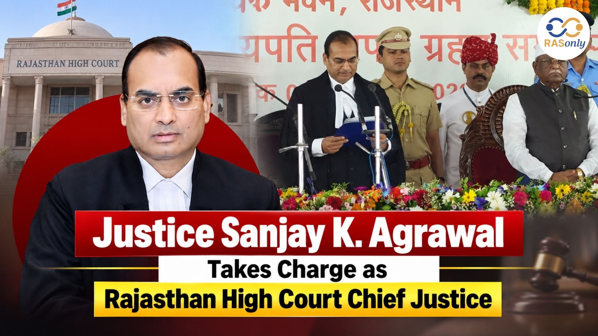
Justice Agrawal Becomes 44th CJ of Rajasthan HC
September 08, 2026
Udaipur Air Pollution August 2026
September 08, 2026
Justice Sanjay Agrawal New Rajasthan HC Chief Justice
September 07, 2026