Jainism: Founder, Symbol, Teachings, Beliefs, History & Principles
Rivers, Lakes, and Dams of Rajasthan: Complete Notes for RAS Exam Preparation

Get in Touch with RASonly!

Rivers, Lakes, and Dams of Rajasthan form one of the most scoring yet tricky sections of Rajasthan Geography for every RAS aspirant. Being the largest state with the least water, Rajasthan survives on just a handful of rivers, a mix of natural and man-made lakes, and a strong network of dams and canals. This guide breaks down every river's origin, tributaries, major lakes, and key dams in one place, so your revision stays quick, complete, and exam-focused.

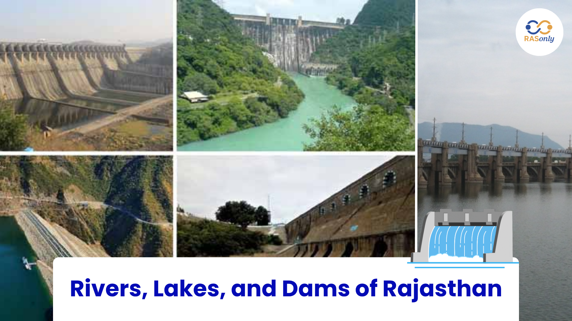
1. Water Resources of Rajasthan
Rajasthan is the largest state of India by area, but it is also one of the driest and most water-stressed states in the country. Despite covering more than 10% of India's landmass, the state holds barely about 1% of the nation's surface water and roughly 1.7% of its groundwater resources. This mismatch between size and water availability is what makes the topic of Rivers, Lakes, and Dams of Rajasthan one of the most frequently examined portions of Rajasthan Geography in the RAS Prelims and Mains examinations.
The state's arid and semi-arid climate, low and erratic rainfall, and the presence of the Thar Desert in the west have together shaped a unique drainage system. Unlike states with large perennial rivers, Rajasthan depends heavily on seasonal rivers, man-made lakes, canals, and dams to meet its drinking water and irrigation needs. Understanding the origin, course, tributaries, and associated dams of each river, along with the classification of lakes and the details of major reservoirs, is essential for scoring well in this section.
2. The Drainage System of Rajasthan
The Aravalli Range acts as the great water divide of Rajasthan, splitting the state's drainage into two broad halves. Rivers originating on the eastern slopes of the Aravallis flow towards the Chambal-Yamuna-Ganga system and eventually reach the Bay of Bengal, while rivers on the western and southern slopes either flow towards the Arabian Sea (via the Gulf of Khambhat) or simply disappear into the sand of the Thar Desert, forming what is called an inland or endorheic drainage system.
A key fact frequently asked in exams is that nearly 60% of the geographical area of Rajasthan falls under the inland drainage system, meaning that most western Rajasthan rivers never reach the sea at all. The state is officially divided into 14 major river basins (watersheds), which are further split into 59 sub-basins for water resource planning.
Classification of Rajasthan's Rivers by Direction of Flow
| Category | Rivers Included | Final Destination |
|---|---|---|
| Flowing towards Bay of Bengal | Chambal, Banas, Banganga, Kali Sindh, Kothari, Khari, Gambhiri, Parvati, Bedach | Join Yamuna → Ganga → Bay of Bengal |
| Flowing towards Arabian Sea | Luni, Mahi, Som, Jakham, Sabarmati, Sukri | Gulf of Khambhat / Rann of Kutch |
| Inland (Endorheic) Drainage | Ghaggar, Kantli, Kakni, Mendha, Sabi | Disappear into the desert or salt lakes (e.g., Sambhar Lake) |
An important exam fact: only two rivers of Rajasthan are truly perennial (flow throughout the year) - the Chambal and the Mahi. Every other river in the state, including the well-known Luni and Banas, is seasonal and swells only during the monsoon. Two districts of Rajasthan, Churu and Bikaner, have no river flowing through them at all, while Kota and Chittorgarh districts see the maximum river flow in the state..
3. Major Rivers of Rajasthan
Chambal River - The Only Perennial River
The Chambal is, without question, the most important river of Rajasthan from an examination point of view because it is the only major perennial river of the state and carries the largest network of dams. In ancient times it was known as the Charmanvati or Kamdhenu river. It originates from the Janapav Hills near Mhow, on the Vindhyan Range in Madhya Pradesh, and enters Rajasthan near Chaurasigarh, forming part of the boundary between Kota and Bundi districts.
The Chambal flows through Kota, Bundi, Sawai Madhopur, Karauli, and Dholpur districts before finally joining the Yamuna in Etawah district of Uttar Pradesh. Its important tributaries are the Banas, Kali Sindh, Parvati, Bamni, and Kurari. The river is also known for the famous Chuliya Waterfall near Bhainsrorgarh and for the deep ravines (badlands) it has carved out around Kota and Chittorgarh, which are notorious for their historical association with dacoits.
The Chambal Valley Project, one of the earliest multi-purpose river valley projects of independent India, has resulted in a chain of four major dams built one after another on this single river: Gandhi Sagar Dam, Rana Pratap Sagar Dam, Jawahar Sagar Dam, and the Kota Barrage. This chain is a favourite topic for RAS Prelims MCQs and Mains map-based questions.
Banas River - 'Hope of the Forest'
The Banas is entirely a Rajasthan river, meaning its complete course of about 512 km lies within the state - a fact often tested directly in exams. It originates from the Khamnor hills of the Aravalli Range near Kumbhalgarh in Rajsamand district. The name Banas literally means 'hope of the forest' (Van-Aas).
It flows through Udaipur, Rajsamand, Chittorgarh, Bhilwara, Ajmer, and Tonk districts, and finally meets the Chambal at a place called Rameshwaram Ghat in Sawai Madhopur district - this meeting point is historically important as one of the Triveni Sangams (river confluences) of Rajasthan. Its major tributaries include the Kothari, Khari, Bedach, Dhundh, Mashi, and Morel. The Bisalpur Dam, one of the most important drinking-water dams of Rajasthan supplying Jaipur, Ajmer, and Tonk, is constructed on this very river near Deoli in Tonk district.
Luni River - The 'Vanishing River'
The Luni is the largest and most significant river of western Rajasthan, though it is entirely seasonal. It originates near the Naga Hills close to Ajmer (Pushkar) and flows in a south-westerly direction through Jodhpur, Pali, Barmer, and Jalore before entering Gujarat and finally disappearing into the marshy Rann of Kutch - which is exactly why it is nicknamed the 'Vanishing River of Rajasthan.'
Interestingly, up to Balotra the river's water remains relatively sweet, but beyond Balotra it turns increasingly saline - a distinctive feature that examiners like to test. Its Sanskrit name, Lavanavari, itself means 'salt river.' Important tributaries of the Luni include the Jawai, Sukri, Jojari, Bandi, Mithri, Khari, Guhiya, and Sagi. The famous Jawai Dam, a lifeline for Jodhpur city and part of Pali district, is built on the Jawai tributary near Sumerpur.
Mahi River - Second Perennial River
The Mahi is the second perennial river of Rajasthan besides the Chambal. It originates at Minda village in the Dhar district of Madhya Pradesh, enters Rajasthan through the Vagad region (Banswara and Dungarpur districts), and eventually flows into the Gulf of Khambhat in the Arabian Sea. Along with the Narmada and Tapti, it is one of only three major west-flowing rivers of peninsular India. The Mahi Bajaj Sagar Dam, named after the philanthropist Jamnalal Bajaj, is built on this river near Banswara and is the second largest dam in Rajasthan by size.
Other Important Rivers
Besides the four rivers above, several smaller rivers are regularly asked about in RAS exams for their origin points and drainage direction.
| River | Origin | Key Fact |
|---|---|---|
| Sabarmati | Aravalli Range, Udaipur district (Padrara/Gogunda Hills) | Only 48 km flows in Rajasthan; the remaining 323 km is in Gujarat; empties into the Gulf of Khambhat. |
| Ghaggar | Shivalik Hills (Himachal Pradesh) | An intermittent (seasonal) river associated with the mythical Saraswati; disappears in the Thar Desert near Hanumangarh/Sriganganagar. |
| Banganga | Bairath Hills, Jaipur district | Flows east through Sawai Madhopur and Bharatpur before joining the Yamuna River. |
| Kantli (Katli) | Khandela Hills, Sikar district | The only major river of the Shekhawati region; disappears into the sandy plains. |
| Som & Jakham | Udaipur and Chittorgarh districts | Important tributaries of the Mahi River system in southern Rajasthan. |
| Kothari | Deoli area, Udaipur district | A left-bank tributary of the Banas River. |
Important River Confluences (Triveni Sangam)
Confluence points are a high-yield micro-topic. The most important is the meeting of the Banas, Chambal, and Seep rivers at Rameshwaram in Sawai Madhopur district, which is popularly compared to the Prayag Sangam of Uttar Pradesh. Another exam fact worth remembering: among all Rajasthan rivers, only the Banganga and the Chambal fall directly into the Yamuna, while the Chambal, Banas, and Luni are the three rivers that pass through the maximum number of districts (six each).
4. Lakes of Rajasthan
Rajasthan's lakes are broadly classified into two categories based on water quality: fresh-water lakes, most of which are man-made (artificial) reservoirs created by damming rivers, and salt-water lakes, which are natural and mostly found in the western and north-western parts of the state - believed by many geographers to be relics of the ancient Tethys Sea. Lakes form a rich, high-weightage topic because questions often combine geography with history (who built the lake, in which century) and current affairs (Ramsar sites, conservation programs).
Freshwater Lakes
| Lake | District | Key Facts |
|---|---|---|
| Jaisamand (Dhebar) | Udaipur | Largest artificial freshwater lake in Rajasthan and the second largest in India; built by Maharana Jai Singh (1685–91) by damming the Gomti River; has 7 islands, the largest being Baba ka Bhagda. |
| Rajsamand | Rajsamand | Built by Maharana Raj Singh I (1662–76) on the Gomti, Kelwa and Tali rivers; famous for the historic Rajprashasti inscription. |
| Pichola | Udaipur | Built in 1525 by a Banjara named Pichhu and later enlarged by Maharana Udai Singh; includes Jag Mandir and Jag Niwas (Lake Palace) islands. |
| Fateh Sagar | Udaipur | Originally built (1678–80) by Maharana Jai Singh and rebuilt in 1889 by Maharana Fateh Singh; connected to Pichola through the Swaroop Sagar Canal. |
| Ana Sagar | Ajmer | Built by Anaji Chauhan (Arnoraj) in 1137 AD; Mughal Emperor Shah Jahan later added the marble Baradari pavilions. |
| Nakki Lake | Sirohi (Mount Abu) | Highest (about 1,200 m) and coldest lake in Rajasthan; the state's only hill-station lake; believed to have been carved by nails ("nakh"). |
| Siliserh Lake | Alwar | Built by Maharaja Vinay Singh in the 19th century; known for its scenic lake palace and proximity to Sariska. |
| Pushkar Lake | Ajmer | Rajasthan's holiest lake; associated with Lord Brahma and the renowned Kartik Purnima Fair. |
Salt Water Lakes
Salt lakes of Rajasthan are commercially important because they supply a large share of India's edible and industrial salt. The undisputed champion of this category - and one of the most repeated single facts in Rajasthan GK - is the Sambhar Lake.
| Lake | District | Key Facts |
|---|---|---|
| Sambhar Lake | Jaipur–Nagaur Border | Largest inland salt-water lake in India and the third-largest salt lake in India; a Ramsar Wetland site since 1990; salt is produced through solar evaporation (March–July) by Sambhar Salts Ltd; fed by the Mendha, Samaod, Mantha, Rupangarh and Khandel rivers. |
| Didwana Lake | Nagaur | Second most important salt-producing lake in Rajasthan; also produces sodium sulphate and sodium sulphide. |
| Pachpadra Lake | Barmer | Produces high-purity salt comparable to sea salt; traditional 'Morli' brush technique is used by the Kharwal community. |
| Lunkaransar Lake | Bikaner | Located about 80 km from Bikaner city; a seasonal salt lake. |
| Kuchaman Lake | Nagaur | A smaller but locally important salt-producing lake. |
A useful mnemonic-style exam point: Five Rajasthan lakes - Ana Sagar (Ajmer), Pushkar (Ajmer), Pichola (Udaipur), Fateh Sagar (Udaipur), and Nakki Lake (Sirohi) - have been included under the National Lake Conservation Programme (NLCP) run by the Union Ministry of Environment, Forest and Climate Change.
5. Dams of Rajasthan
Because Rajasthan has so few perennial rivers, dams and reservoirs play a role here that is even more critical than in most Indian states - they store scarce monsoon run-off for irrigation, drinking water, and, in a few cases, hydroelectricity. Most dam-related questions in RAS focus on the river on which the dam stands, the district, the year of completion, and its main purpose.
The Chambal Valley Project - A Chain of Four Dams
This is the single most important dam-cluster for the exam, since all four structures lie on one river in a fixed sequence.
| Dam | Location | Completed | Purpose / Key Fact |
|---|---|---|---|
| Gandhi Sagar Dam | Rajasthan–Madhya Pradesh Border (mostly in MP) | 1960 | First dam of the Chambal Valley Project; a 64 m high masonry gravity dam with five hydroelectric generating units. |
| Rana Pratap Sagar Dam | Rawatbhata, Chittorgarh | 1970 | Second dam in the series; named after Maharana Pratap; has a hydropower station at its toe. |
| Jawahar Sagar Dam | Kota District (downstream of Rana Pratap Sagar) | 1972 | Third dam in the project; a 45 m high concrete gravity dam generating about 60 MW of hydropower. |
| Kota Barrage | Kota City | 1960 | Final structure of the Chambal Valley Project; diverts water into irrigation canals serving Rajasthan and Madhya Pradesh. |
Other Major Dams
| Dam | River | District | Key Fact |
|---|---|---|---|
| Bisalpur Dam | Banas | Tonk |
|
| Jawai Dam | Jawai (Tributary of Luni) | Pali (near Sumerpur) |
|
| Mahi Bajaj Sagar Dam | Mahi | Banswara |
|
| Jakham Dam | Jakham | Pratapgarh |
|
| Morel Dam | Morel | Sawai Madhopur (near Lalsot) |
|
| Panchna Dam | Gambhiri/Banas System | Karauli |
|
| Sei Dam | Sei (Tributary of Sabarmati) | Udaipur (Kotra Tehsil) |
|
6. The Indira Gandhi Canal - Lifeline of the Thar
No discussion of Rajasthan's water resources is complete without the Indira Gandhi Canal (formerly the Rajasthan Canal), the longest canal in India. It brings water from the Sutlej and Beas rivers in Punjab (via the Harike Barrage) all the way into the driest districts of Rajasthan - Ganganagar, Hanumangarh, Bikaner, Churu, and Jaisalmer, transforming vast stretches of desert into productive agricultural land. Because it does not originate from within the state, it is technically a canal rather than a river, but it is treated as an inseparable part of Rajasthan's water-resource infrastructure and is a recurring topic in both Prelims and Mains.
7. Quick Revision Points for RAS Exam
- Only two perennial rivers of Rajasthan: Chambal and Mahi.
- Chambal is the only river whose entire dam-chain (four dams) lies within/adjoining Rajasthan: Gandhi Sagar → Rana Pratap Sagar → Jawahar Sagar → Kota Barrage.
- Banas is the only major river whose entire course lies inside Rajasthan (512 km).
- Luni is called the 'Vanishing River' as it disappears into the Rann of Kutch; water turns saline after Balotra.
- Districts with no river at all: Churu and Bikaner.
- Districts with maximum river flow: Kota and Chittorgarh.
- Rameshwaram (Sawai Madhopur) - confluence (Triveni Sangam) of Banas, Chambal and Seep rivers.
- Only Banganga and Chambal fall directly into the Yamuna.
- Sambhar Lake is the largest inland salt-water lake of India; declared a Ramsar site in 1990.
- Jaisamand Lake (Udaipur) is the largest artificial fresh-water lake of Rajasthan.
- Five NLCP lakes: Ana Sagar, Pushkar, Pichola, Fateh Sagar, and Nakki Lake.
- Bisalpur Dam (Banas River, Tonk) supplies drinking water to Jaipur, Ajmer and Tonk.
- Mahi Bajaj Sagar Dam is the second largest dam of Rajasthan, after the Chambal Valley dams.
- Indira Gandhi Canal brings Sutlej-Beas water into western Rajasthan; it is India's longest canal.
- Rajasthan has 14 major river basins divided into 59 sub-basins; roughly 60% of the state has inland drainage.
Conclusion
Rivers, Lakes, and Dams of Rajasthan is not just a chapter to memorize - it's a topic that connects geography, history, and current affairs into one exam-friendly package. From the Chambal being the state's only true lifeline river to Sambhar Lake's salt story to the four-dam chain of the Chambal Valley Project, every fact here has appeared in some form in past RAS Prelims or Mains papers. Keep the tables and quick revision points from this guide close during your final days of preparation and revise the river-dam-district linkages regularly, and you'll be able to answer almost any question this topic throws at you with confidence.
FAQs
The Chambal is the primary perennial river of Rajasthan, along with the Mahi, which also flows throughout the year. Every other river in the state, including the Luni and Banas, is seasonal and depends entirely on monsoon rainfall.
The Luni River is known as the Vanishing River because it disappears into the marshy Rann of Kutch instead of reaching the sea. It is also called Lavanavari, meaning 'salt river' in Sanskrit, since its water turns saline after Balotra.
Sambhar Lake, spread across the Jaipur-Nagaur border, is the largest lake of Rajasthan and the largest inland salt-water lake in India. For fresh water, Jaisamand Lake in Udaipur holds the record as the largest artificial fresh-water lake in the state.
The Chambal Valley Project consists of four dams built in sequence: Gandhi Sagar Dam, Rana Pratap Sagar Dam, Jawahar Sagar Dam, and the Kota Barrage. This dam chain is one of the most frequently asked topics in RAS exams.
The Bisalpur Dam, built on the Banas River in Tonk district, is the main source of drinking water for Jaipur, Ajmer, and Tonk, and its water is also transported to Bhilwara via Nasirabad.

BEST SELLER
🏆 PRELIMS
RAS Pass
Prelims focused Hindi & English
₹399
✓
Prelims Topic-Wise Tests
✓
Subject-Wise Tests
✓
Full-Length Prelims Tests
✓
Daily Current Affairs Tests
✓
Prelims PYQs Tests
✓
Detailed Solutions & Analysis
✓
All Rajasthan Ranking
✓
Unlimited Reattempts
✓
Mains Tests
✓
Hindi & English Tests
✓
All Rajasthan Ranking
Trusted by 5,000+ Students

Post Category
- RAS Salary
- Result
- RAS Admit Card
- RAS Job
- RAS Cutoff
- Preparation Tips
- RAS Answer Key
- RAS Exam Analysis
- RAS Syllabus
- RAS Previous Year Papers
- RPSC RAS Exam Pattern
- RAS Interview
- RAS Exam Date
- RAS Vacancy
- RAS Test Series
- RAS Best Books
- RAS Preparation Resources
- RAS Coaching Centre
- History
- Polity
- Geography
- Economics
- Science
- Art and Culture
- RPSC RAS Application Form
- RPSC RAS Notification
- RAS Eligibility Criteria
- UPSC Exam
- RPSC RAS Mains
Visit Our RASonly Offline Center
Our Expert Faculty

Bhunesh Sir
Current Affairs · 13+ Yrs

Aamir Khan Sir
RAS-2017 · IIM Ahm.

Akash Sir
Polity · 8+ Yrs
Free Resources
Official Mobile App

RASOnly App
by OTSAdda · Free
Full Video Lectures
Mock Tests & PYQs
Daily Current Affairs
AI Mock Interview
Free Download · No subscription needed to install
RAS 2024 Toppers — RASonly
Rank 2
Virendra Charan
Rank 9
Bhoopinder Singh
Rank 26
Aanchal Nagpal
Rank 33
Lokendra Singh
Rank 45
Amar Rathore
Rank 46
Manasvini Verma

Join RASonly WhatsApp Community
Get daily current affairs, exam alerts, free study material and tips from expert faculty — right on WhatsApp.
Join for Free →RASonly Interview Guidance Program

Mr. Ashok Jain
Ex-Chief Secretary Govt of Rajasthan
- IAS officer of the 1981 batch, Rajasthan cadre.
- Passionate about mentoring the next generation of RAS officers with real-world insights.
- Got retired in Dec 2017 from the post of Chief Secretary of the state of Rajasthan.

Mr. Guru Charan Rai
Ex-ASP / SP in Jaisalmer
- Guru Charan Rai, IPS (Retd), retired as Inspector General of Police (Security), Rajasthan, Jaipur in 2017.
- Served as ASP and SP in Jaisalmer, Nagaur, Sri Ganganagar, Sawai Madhopur, Dausa, Sikar, and Karauli.
- He also held key positions as DIGP and IGP in the Law and Order division.

Mr. Rakesh Verma
Ex-IAS Officer, B.Tech, MBA, and M.A. (Economics)
- IAS officer of the 1981 batch and retired in Chief Secretary Rank.
- Civil servant of high repute and vast experience.
- Has been teaching UPSC CSE subjects for the last six years.
Daily Current Affairs for RAS Exam Preparation 2026

25th SCO Foreign Trade Ministers' Meeting
September 19, 2026
India’s flag bearer at the opening ceremony of the...
September 19, 2026
PM-YASASVI Scheme Update 2026
September 18, 2026