Chola Dynasty: Capital, Founder, Kings, Time Period and History
What is Cyclone, The Reason For The Formation Of The Cyclone

Get in Touch with RASonly!

Formation of Cyclone explained step-by-step for RAS, UPSC and state-level exam aspirants. Learn how warm ocean temperature, humidity, wind shear and the Coriolis force combine to trigger cyclogenesis, along with the stages of cyclone formation, its structure (eye, eye wall, rain bands), types of cyclones, and India-specific facts on Bay of Bengal cyclones. Includes bilingual explanations and exam-focused FAQs to help you master this Indian Geography topic confidently.

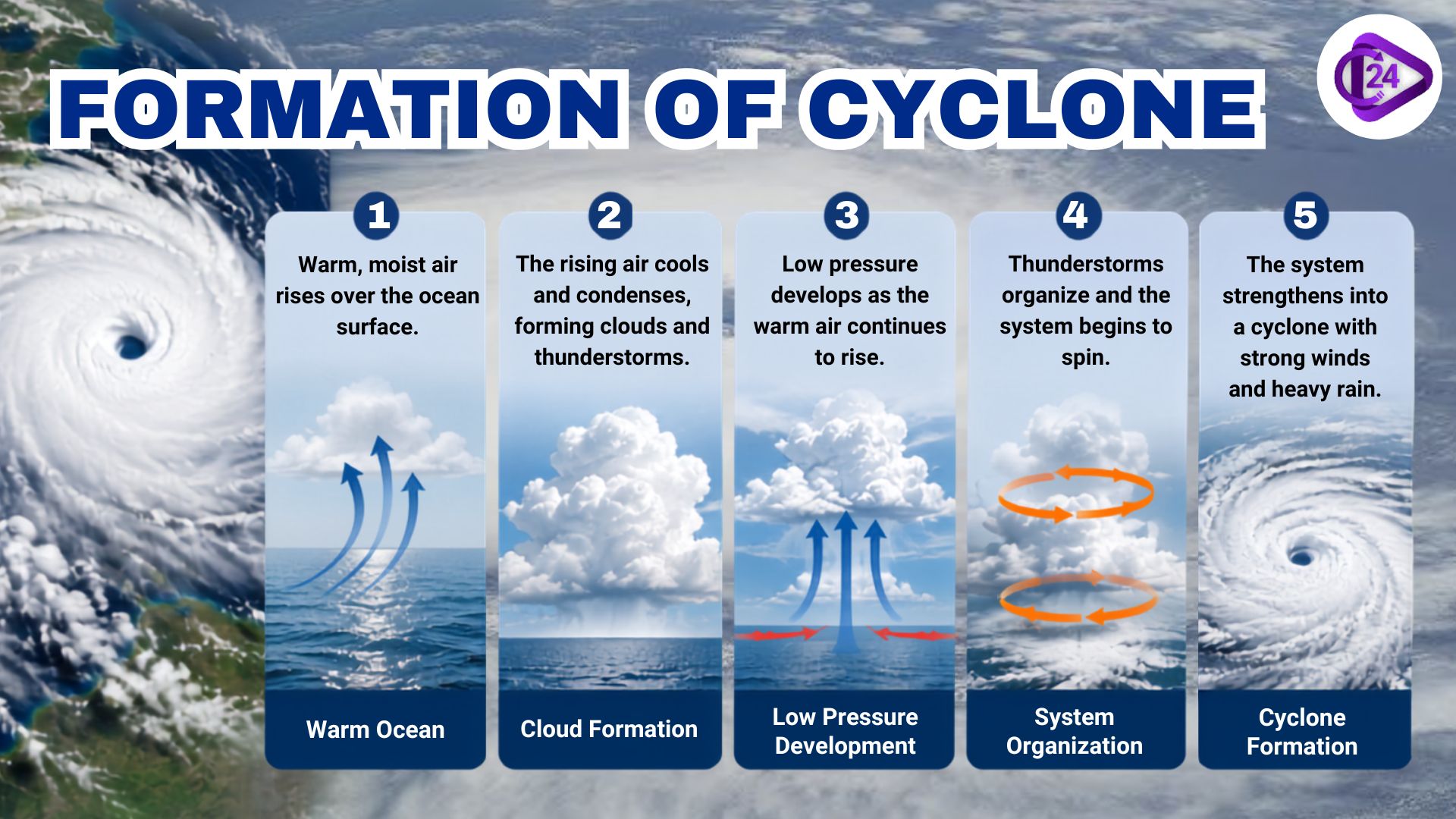
If you're preparing for RAS, UPSC, or any state-level competitive exam, the formation of cyclone is a topic you simply can't skip in Indian Geography. Cyclones are massive, rotating weather systems that build up around a low-pressure core, and getting there involves a whole sequence of atmospheric events lining up just right. This article walks through the actual cyclone formation process, the conditions that need to be present, what a cyclone looks like structurally, the different types you'll be asked about, and a set of FAQs that mirror how these questions actually show up in exams.
Here's the thing about tropical cyclone formation it's not something that happens overnight or by chance. It takes the right ocean temperature, the right wind behavior, and the right pressure setup, all working in sync over a period of several days. Once this process is clear in your head, even a question phrased casually as "cyclone kaise banta hai" won't trip you up in either prelims or mains.
What Exactly Is a Cyclone?
At its core, a cyclone is an organized system of storm clouds spinning around a low-pressure center, usually born over warm tropical or subtropical seas. Direction of rotation depends on hemisphere counter-clockwise in the Northern Hemisphere (thanks to the Coriolis effect), clockwise in the Southern. This spinning mechanism is really the heart of what geography textbooks describe as chakravat ka nirman.
Interestingly, the same weather phenomenon goes by different names depending on where in the world it occurs:
| Region | Local Name |
|---|---|
| North Indian Ocean (India) | Cyclone |
| North Atlantic & Northeast Pacific | Hurricane |
| Northwest Pacific | Typhoon |
| South Pacific & Indian Ocean | Cyclone |
| Australia | Willy-Willy |
Conditions Needed for a Cyclone to Form
The चक्रवात के निर्माण की प्रक्रिया doesn't rely on just one factor - it needs several oceanic and atmospheric conditions to align at the same time. Miss even one, and the storm either won't form or won't survive long enough to intensify.
- Warm Ocean Surface Temperature - The sea surface needs to stay at 26–27°C or above, down to roughly 60 metres in depth. This warmth is what supplies the latent heat energy that essentially powers the storm.
- High Humidity - There has to be enough moisture in the lower and mid-troposphere to keep feeding cloud formation continuously.
- Low Vertical Wind Shear - Wind speed and direction shouldn't change too drastically between lower and upper atmospheric levels; strong shear tends to tear apart a developing storm before it can organize.
- Coriolis Force - Generated by Earth's own rotation, this force gives the storm its spin. It's practically absent within 5° of the equator, which explains why cyclones almost never form there.
- Pre-existing Low-Pressure Disturbance - Most cyclones start life as a weak low-pressure zone or minor tropical disturbance that acts as the seed.
- Upper Level Divergence - Air needs to flow outward at higher altitudes so the rising air from below has somewhere to go, keeping the low-pressure system going.
These six points essentially cover everything examiners are looking for when they ask about चक्रवात की उत्पत्ति की परिस्थितियाँ, so it's worth having each one clear in your mind rather than just memorised.
How Does a Cyclone Actually Form? (Step by Step)
The technical name for this process is cyclogenesis, and while it sounds complicated, it's easier to grasp once you break it into stages.
Stage 1: A Low-Pressure Area Forms
Warm ocean water heats the air sitting above it. That warm air rises quickly, and as it does, it leaves a pocket of lower pressure behind near the surface.
Stage 2: Air Rushes In to Fill the Gap
Cooler air from nearby high-pressure zones moves in to fill that low-pressure pocket. This incoming air also warms up and rises, and the cycle keeps repeating.
Stage 3: Clouds Start Forming
As the warm, moisture-laden air keeps rising, it cools down at higher altitudes and condenses into clouds. This condensation releases latent heat, which warms the surrounding air even further and speeds up the whole rising process - intensifying the low-pressure system in the bargain.
Stage 4: The System Starts Spinning
As more air gets pulled toward the center, Earth's rotation kicks in and forces the whole system to spin - counter-clockwise if you're in the Northern Hemisphere. This is what turns a messy cluster of thunderstorms into an organized, circular system.
Stage 5: The Eye Takes Shape
Once wind speeds pick up and the system gains strength, a calm, clear patch forms right at the center this is the eye of the cyclone. Around it sits the "eye wall," which is actually where the strongest winds and heaviest rain occur, not the eye itself.
Stage 6: Peak Strength and Decline
As long as the cyclone stays over warm water, it keeps intensifying. The moment it crosses onto land or moves over cooler water, it's cut off from its energy source and starts weakening a phase generally referred to as dissipation.
_1786100174.jpeg)
What Does a Cyclone Look Like Inside? (चक्रवात की संरचना)
| Part of Cyclone | Description |
|---|---|
| Eye | The calm center with clear skies and light winds. |
| Eye Wall | Ring of intense thunderstorms surrounding the eye where the strongest winds occur. |
| Rain Bands | Spiral bands of clouds and heavy rain extending outward from the eye wall. |
| Outflow | High-altitude winds that push air away from the storm, helping maintain cyclone circulation. |
Types of Cyclones You Should Know (चक्रवात के प्रकार)
Cyclones aren't all the same - they're categorized based on where and how they form:
- Tropical Cyclones - Develop over warm tropical seas, typically between 5° and 30° latitude. This category includes Indian Ocean cyclones as well as hurricanes and typhoons.
- Extratropical Cyclones - Form in mid-latitude or polar zones, driven by temperature contrasts between air masses rather than ocean heat.
- Polar Cyclones - Occur near the poles; smaller in scale and rarely a major focus in Indian exams.
- Sub-tropical Cyclones - A hybrid type that shows features of both tropical and extratropical systems.
Cyclone Formation in India - What RAS Aspirants Should Remember
- The Bay of Bengal sees far more cyclonic activity than the Arabian Sea, mainly because of warmer sea surface temperatures and greater moisture supply from the monsoon system.
- India's cyclone-prone windows are the pre-monsoon months (April–May) and the post-monsoon months (October–December).
- IMD (India Meteorological Department) functions as the Regional Specialized Meteorological Centre (RSMC) for the North Indian Ocean, responsible for naming cyclones and issuing official warnings.
- Odisha, Andhra Pradesh, Tamil Nadu, and West Bengal are consistently among the worst-hit states.
Why RAS Aspirants Should Take This Topic Seriously
The question of चक्रवात का निर्माण appears frequently in RAS Prelims (Geography) and also comes up as a descriptive question in the RAS Mains a lot. This is typically tested through:
- Explain how a tropical cyclone is formed under certain conditions.
- How to tell tropical and extratropical cyclones apart
- The development of cyclones and their stages were described and illustrated. Stages and structure of a developing cyclone were described and illustrated.
- Discussing the impact of cyclones on the coastal state of India.
If you have mastered this process (not just memorized it) then there are no problems in answering MCQs and long-form questions.
Important Links
Conclusion
The recipe for a cyclone is a relatively sensible sequence of events - warm ocean water, adequate humidity, little wind shear and the rotational power of the Earth. A proper understanding of the working of a cyclone (chakravat ka nirman), the stages of a cyclone and cyclone patterns in India would definitely benefit students in Prelims as well as Mains for any preparation for RAS. This also helps by practising a couple of diagram-based questions as well as this theory, cyclone structure diagrams are more common than you think.
FAQs on Formation of Cyclone
The formation of a cyclone begins when warm ocean water heats the air above it, creating a low-pressure zone that pulls in moist air. As this air rises and condenses, the Coriolis force sets the whole system spinning into an organized cyclone.
A tropical cyclone needs a sea surface temperature of at least 26–27°C down to about 60 metres depth. This warmth supplies the latent heat energy that keeps the storm growing.
Cyclone formation moves through six stages – from a low-pressure area and inflowing air to cloud formation, rotation, eye development, and final dissipation. Together, these stages explain the complete cyclogenesis process.
The Bay of Bengal has warmer sea surface temperatures and a richer moisture supply from the monsoon, making it far more favourable for cyclone formation. This is why Bay of Bengal cyclones are more frequent and often stronger.
Cyclone formation depends heavily on the Coriolis force, which gives the storm its spin, but this force is almost zero within 5° of the equator. Without enough Coriolis force, cyclonic rotation simply can't develop there.
The India Meteorological Department (IMD) acts as the Regional Specialised Meteorological Centre (RSMC) for the North Indian Ocean. It handles cyclone naming and issues official warnings for cyclone formation in the region.

BEST SELLER
🏆 PRELIMS
RAS Pass
Prelims focused Hindi & English
₹399
✓
Prelims Topic-Wise Tests
✓
Subject-Wise Tests
✓
Full-Length Prelims Tests
✓
Daily Current Affairs Tests
✓
Prelims PYQs Tests
✓
Detailed Solutions & Analysis
✓
All Rajasthan Ranking
✓
Unlimited Reattempts
✓
Mains Tests
✓
Hindi & English Tests
✓
All Rajasthan Ranking
Trusted by 5,000+ Students

Post Category
- RAS Salary
- Result
- RAS Admit Card
- RAS Job
- RAS Cutoff
- Preparation Tips
- RAS Answer Key
- RAS Exam Analysis
- RAS Syllabus
- RAS Previous Year Papers
- RPSC RAS Exam Pattern
- RAS Interview
- RAS Exam Date
- RAS Vacancy
- RAS Test Series
- RAS Best Books
- RAS Preparation Resources
- RAS Coaching Centre
- History
- Polity
- Geography
- Economics
- Science
- Art and Culture
- RPSC RAS Application Form
- RPSC RAS Notification
- RAS Eligibility Criteria
- UPSC Exam
- RPSC RAS Mains
Visit Our RASonly Offline Center
Our Expert Faculty

Bhunesh Sir
Current Affairs · 13+ Yrs

Aamir Khan Sir
RAS-2017 · IIM Ahm.

Akash Sir
Polity · 8+ Yrs
Free Resources
Official Mobile App

RASOnly App
by OTSAdda · Free
Full Video Lectures
Mock Tests & PYQs
Daily Current Affairs
AI Mock Interview
Free Download · No subscription needed to install
RAS 2024 Toppers — RASonly
Rank 2
Virendra Charan
Rank 9
Bhoopinder Singh
Rank 26
Aanchal Nagpal
Rank 33
Lokendra Singh
Rank 45
Amar Rathore
Rank 46
Manasvini Verma

Join RASonly WhatsApp Community
Get daily current affairs, exam alerts, free study material and tips from expert faculty — right on WhatsApp.
Join for Free →RASonly Interview Guidance Program

Mr. Ashok Jain
Ex-Chief Secretary Govt of Rajasthan
- IAS officer of the 1981 batch, Rajasthan cadre.
- Passionate about mentoring the next generation of RAS officers with real-world insights.
- Got retired in Dec 2017 from the post of Chief Secretary of the state of Rajasthan.

Mr. Guru Charan Rai
Ex-ASP / SP in Jaisalmer
- Guru Charan Rai, IPS (Retd), retired as Inspector General of Police (Security), Rajasthan, Jaipur in 2017.
- Served as ASP and SP in Jaisalmer, Nagaur, Sri Ganganagar, Sawai Madhopur, Dausa, Sikar, and Karauli.
- He also held key positions as DIGP and IGP in the Law and Order division.

Mr. Rakesh Verma
Ex-IAS Officer, B.Tech, MBA, and M.A. (Economics)
- IAS officer of the 1981 batch and retired in Chief Secretary Rank.
- Civil servant of high repute and vast experience.
- Has been teaching UPSC CSE subjects for the last six years.
Related Post



Daily Current Affairs for RAS Exam Preparation 2026
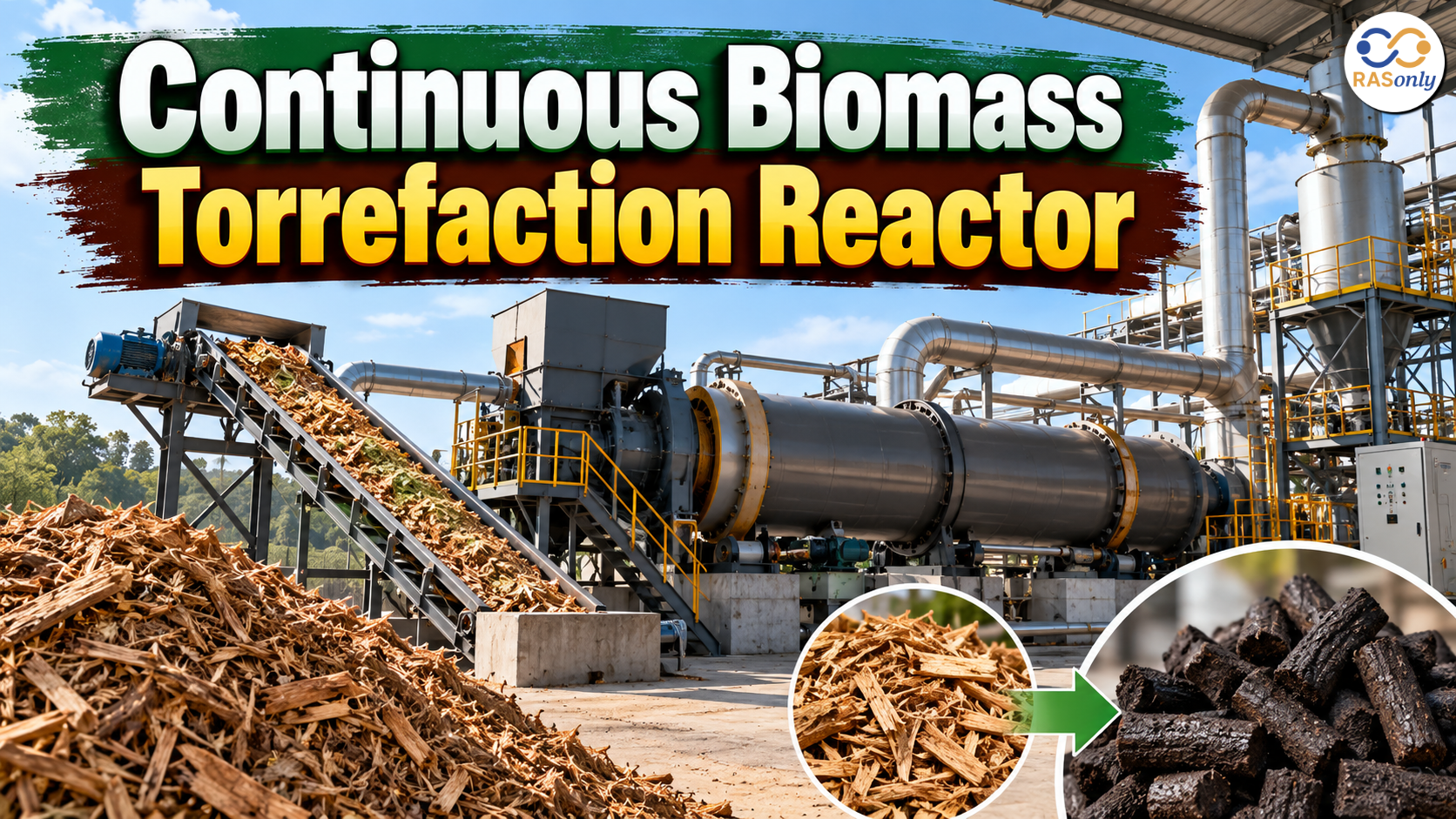
Continuous Biomass Torrefaction Reactor
October 17, 2026
Shri Jaswant Exhibition and Cattle Fair
October 17, 2026
9th Rashtriya Poshan Maah 2026
October 16, 2026