RAS Application Fees & Application Process 2026 - Complete Guide
Major Rivers of Rajasthan

Get in Touch with RASonly!

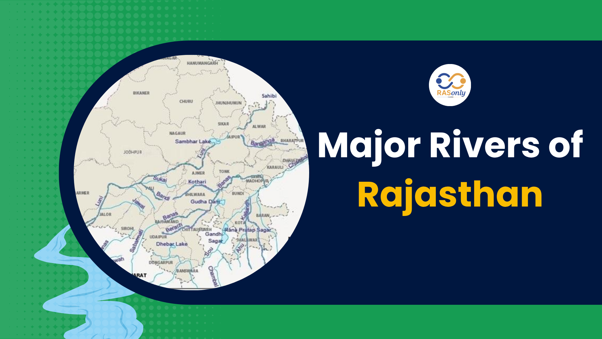
Rajasthan has an arid to semi-arid climatic condition and hence its drainage system is mainly inland. It has got rivers flowing into the Arabian Sea or Bay of Bengal or at the end in salt lakes and basins. Important rivers are Chambal, Banas, Luni and Sabarmati. Patterns of drainage range between dendritic and those that are radial and annular. These systems are essential to understand how to manage the limited water sources in Rajasthan.
Key Points for RAS Mains
Context
- Rajasthan is the largest state of India which is also a rain-shadow area and hence it experiences poor rainfall as well as a poorly developed drainage system.
- This has created the geographical and climatic states of the state, which have determined the river systems and the water flow pattern in the state.
Classification of Rajasthan’s Drainage System
|
|
|
|
|
|
|
|
|
|
|
|
Major Rivers of Rajasthan
1. Bay of Bengal Drainage System (20 percent)
These rivers end up meeting the Yamuna-Ganga system and flowing into the Bay of Bengal.
- Major Rivers:
- Chambal River:
- Place of origin: Janapav Hills, MP
- Flows through Kota, Sawai Madhopur, Dholpur
- Characteristics: it is a perennial river, one of the major tributaries of Yamuna.
- Banas River:
- Source: Khamnor Hills, Rajsamand
- Meets Chambal at Rameshwar ( Kota )
- Banganga River:
- Made In: Bairath Hills (Jaipur)
- Flows through Bharatpur, joins Yamuna at Fatehabad(U.P.)
- Chambal River:
2. Arabian Sea Drainage System (10%)
The end result of these rivers is that they flow west ending up in the Arabian Sea.
- Major Rivers:
- Luni River:
- Birthplace: Naga Hills (Ajmer)
- Passes through: Pali, Barmer, Jalore
- Rann of Kutch (seasonal river)
- Sub tributaries- Jawai, Sukri, Bandi
- Sabarmati River:
- Dhebar Lake, Udaipur
- drainage basin into the Arabian Sea (via Gujarat)
- Mahi River:
- Madhya Pradesh: Place of origin
- Banswara (Rajasthan) - makes up Mahi Bajaj Sagar Dam
- drainage basin into the Arabian Sea (via Gujarat)
- Luni River:
3. Inland (Endorheic) Drainage System ( 70%)
- These rivers dry up and end at ports of salt waters or deserts.
- Key Features:
- Dominant western Rajasthan (Thar Desert)
- Mostly Rivers are ephemeral and Flow only when it rains (During monsoons)
- Major Rivers:
- Ghaggar River:
- Place of origin: Shivalik Hill, Haryana
- Flow: by Hanumangarh & Sriganganagar
- Association with mythology:The Saraswati River
- Kantli River:
- Jhunjhunu through which it flows and drains into desert basin
- Other temporal brooks:
- Seasonal, rain-fed, evaporate in the desert or depressions
- Ghaggar River:
Drainage Patterns in Rajasthan
|
|
|
|
|
|
|
|
|
|
|
|
|
|
|
|
|
|
|
|
|
|
|
|
Lakes and Basins as Drainage Sinks
- Sambhar Lake (Largest inland salt lake): Receives seasonal drainage from Mendha, Rupangarh rivers
- Pachpadra Lake, Didwana Lake: End points for seasonal streams
- Role: Salt production, water conservation
Significance of Drainage System in Rajasthan
- Aids in eastern Rajasthan agriculture
- The ephemeral river recharge of groundwater
- The salt-making in the salt deserts
- Environmental spirit (e.g., biodiversity) Ecological balance (e.g., wetlands)
Challenges
- The majority of the rivers are seasonal and are very much dependent on monsoon
- Shortage of water in the west districts
- Urban rivers pollution caused by domestic/agriculture sources
- Shortage inter-basin transmission of terrain
The Government Initiative
- Eastern Rajasthan Canal Project (ERCP):
- Aspires to link Chambal and tributaries with the water-stressed places
- Jal Jeevan Mission/Jal Shakti Abhiyan
- Better supply of water in rural areas
- Catch the Rain Campaign:
- Encourages rainwater harvesting and recovery of the old systems
Conclusion for RAS
Due to the climatic and topographic changes, the drainage pattern of Rajasthan comprises a combination of perennial, seasonal and vanishing rivers. It is also quite important to comprehend this rather complex drainage framework with regard to regional water management and even agriculture as well as sustainable development.
Also Read: Rivers, Lakes, and Dams of Rajasthan
Also Read: Soils of Rajasthan
FAQs related to RAS RPSC
Chambal River – a tributary of Yamuna and flows throughout the year.
Luni River – a seasonal river that ends in the Rann of Kutch.
Around 70%, mainly in western arid zones.
Sambhar Lake – the largest inland saltwater lake in India.
Ghaggar River – flows through Hanumangarh and Sriganganagar.
Bay of Bengal system via Chambal → Yamuna → Ganga.
Naga Hills near Ajmer.
Eastern Rajasthan Canal Project (ERCP).
Radial pattern – streams radiate from a central high point.
Recharge groundwater, support agriculture and biodiversity during monsoons.
BEST SELLER
🏆 PRELIMS
RAS Pass
Prelims focused Hindi & English
₹399
✓
Prelims Topic-Wise Tests
✓
Subject-Wise Tests
✓
Full-Length Prelims Tests
✓
Daily Current Affairs Tests
✓
Prelims PYQs Tests
✓
Detailed Solutions & Analysis
✓
All Rajasthan Ranking
✓
Unlimited Reattempts
✓
Mains Tests
✓
Hindi & English Tests
✓
All Rajasthan Ranking
Trusted by 5,000+ Students

Post Category
- RAS Salary
- Result
- RAS Admit Card
- RAS Job
- RAS Cutoff
- Preparation Tips
- RAS Answer Key
- RAS Exam Analysis
- RAS Syllabus
- RAS Previous Year Papers
- RPSC RAS Exam Pattern
- RAS Interview
- RAS Exam Date
- RAS Vacancy
- RAS Test Series
- RAS Best Books
- RAS Preparation Resources
- RAS Coaching Centre
- History
- Polity
- Geography
- Economics
- Science
- Art and Culture
- RPSC RAS Application Form
- RPSC RAS Notification
- RAS Eligibility Criteria
- UPSC Exam
Visit Our RASonly Offline Center
Our Expert Faculty

Bhunesh Sir
Current Affairs · 13+ Yrs

Aamir Khan Sir
RAS-2017 · IIM Ahm.

Akash Sir
Polity · 8+ Yrs
Free Resources
Official Mobile App

RASOnly App
by OTSAdda · Free
Full Video Lectures
Mock Tests & PYQs
Daily Current Affairs
AI Mock Interview
Free Download · No subscription needed to install
RAS 2024 Toppers — RASonly
Rank 2
Virendra Charan
Rank 9
Bhoopinder Singh
Rank 26
Aanchal Nagpal
Rank 33
Lokendra Singh
Rank 45
Amar Rathore
Rank 46
Manasvini Verma

Join RASonly WhatsApp Community
Get daily current affairs, exam alerts, free study material and tips from expert faculty — right on WhatsApp.
Join for Free →RASonly Interview Guidance Program

Mr. Ashok Jain
Ex-Chief Secretary Govt of Rajasthan
- IAS officer of the 1981 batch, Rajasthan cadre.
- Passionate about mentoring the next generation of RAS officers with real-world insights.
- Got retired in Dec 2017 from the post of Chief Secretary of the state of Rajasthan.

Mr. Guru Charan Rai
Ex-ASP / SP in Jaisalmer
- Guru Charan Rai, IPS (Retd), retired as Inspector General of Police (Security), Rajasthan, Jaipur in 2017.
- Served as ASP and SP in Jaisalmer, Nagaur, Sri Ganganagar, Sawai Madhopur, Dausa, Sikar, and Karauli.
- He also held key positions as DIGP and IGP in the Law and Order division.

Mr. Rakesh Verma
Ex-IAS Officer, B.Tech, MBA, and M.A. (Economics)
- IAS officer of the 1981 batch and retired in Chief Secretary Rank.
- Civil servant of high repute and vast experience.
- Has been teaching UPSC CSE subjects for the last six years.
Related Post

Daily Current Affairs for RAS Exam Preparation 2026

Rajasthan to Implement RTD Model
June 23, 2026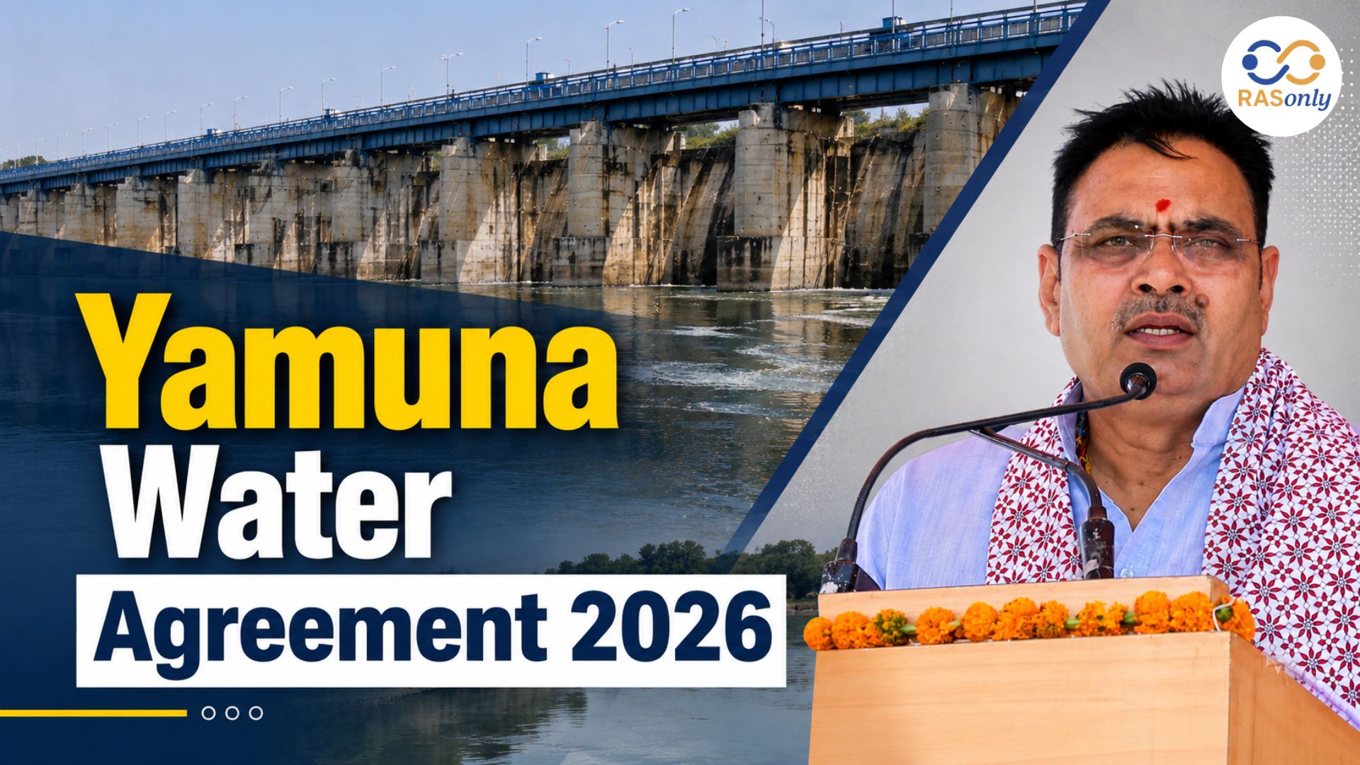
Yamuna Water Agreement 2026
June 23, 2026