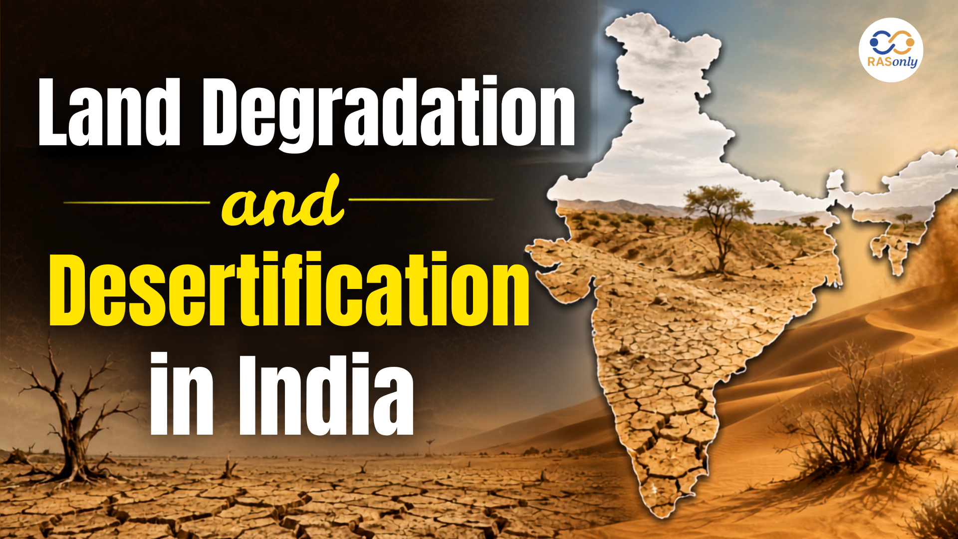
The Desertification and Land Degradation Atlas of India (2018–19) prepared by the Space Applications Centre (SAC), Indian Space Research Organisation (ISRO) states that 29.77% of India's total geographical area (97.85 million hectares) is affected by land degradation and desertification.
The wind erosion is extremely severe in western Rajasthan, particularly in the districts of Jaisalmer, Barmer, and Bikaner, making land conservation and sustainable resource management an urgent priority.
What is Land Degradation?
Land degradation refers to the deterioration of the physical, chemical and biological quality of land, reducing its productivity for agriculture, forests, biodiversity and ecosystem services.
It occurs when natural processes and human activities adversely affect soil, water and vegetation resources.
Major Causes of Land Degradation
Natural and Human-Induced Causes
- Water erosion and wind erosion of soil.
- Deforestation and loss of vegetation cover.
- Unsustainable agricultural practices.
- Overgrazing by livestock.
- Mining and quarrying.
- Rapid urbanisation and industrialisation.
- Climate change and prolonged droughts.
- Excessive exploitation of groundwater and natural resources.
What is Desertification?
Desertification is the gradual degradation of productive land due to climatic variations and unsustainable human activities, particularly in arid, semi-arid and dry sub-humid regions, resulting in declining biological productivity and soil fertility.
It does not necessarily mean the expansion of deserts, but rather the deterioration of productive land.
Effects of Desertification
Major Impacts
- Declining agricultural productivity.
- Loss of fertile topsoil.
- Reduced groundwater recharge.
- Increased frequency of dust storms.
- Loss of biodiversity.
- Threat to rural livelihoods.
- Increased food insecurity.
Desertification and Land Degradation Atlas of India (2018–19)
The Desertification and Land Degradation Atlas of India has been prepared by the Space Applications Centre (SAC), ISRO, using satellite-based monitoring, remote sensing data and GIS technology.
It aims to assess the extent, causes and severity of land degradation across different States and Union Territories.
Key Highlights
National Assessment
- Total geographical area of India: 328.72 million hectares.
- Land degraded and desertified: 97.85 million hectares.
- Percentage of affected area: 29.77%.
- It is India's latest national atlas prepared by ISRO for 2018–19.
- No newer national atlas has been released after the 2018–19 assessment.
- Land degradation continues to increase in India.
Increasing Trend of Land Degradation
The report shows that the degraded area has continuously increased over the last 15 years.
Assessment of Land Degradation
|
|
|
|
|
|
|
|
|
|
|
|
|
|
|
|
Key Observation
Rising Degradation
- An additional 3.32 million hectares of land became degraded between 2003–05 and 2018–19.
- The increase is mainly due to:
- Climate change.
- Unsustainable land use.
- Deforestation.
- Excessive exploitation of natural resources.
Major Causes of Land Degradation in India
ISRO observed that different regions of India experience different forms of land degradation.
|
|
|
|
|
|
|
|
|
|
|
|
1. Water Erosion
Features
- The most significant cause of land degradation.
- Removes fertile topsoil through rainfall and surface runoff.
- Common in hilly regions and river basins.
2. Vegetation Degradation
Causes
- Deforestation.
- Overgrazing.
- Forest fires.
- Excessive exploitation of forests.
Impacts
- Biodiversity loss.
- Declining soil fertility.
3. Wind Erosion
Features
- Severe in arid and semi-arid regions.
- Particularly intense in western Rajasthan.
- Strong winds remove fertile topsoil and nutrients, reducing land productivity.
Impact on Rajasthan
Western Rajasthan experiences some of the most severe wind erosion in the country.
Most Affected Districts
- Jaisalmer.
- Barmer.
- Bikaner.
Why is Rajasthan highly vulnerable?
Reasons
- Arid climate.
- Low rainfall.
- Sparse vegetation.
- Sandy soils.
- High wind velocity.
- Frequent drought conditions.
Consequences
Major Impacts
- Shrinking agricultural land.
- Declining crop productivity.
- Loss of grazing lands.
- Expansion of desertification.
- Reduction in vegetation cover.
- Threat to biodiversity.
- Soil nutrient depletion.
- Economic losses to farmers and pastoral communities.
Measures Required for Rajasthan
An integrated approach towards land restoration is essential.
Conservation Measures
Recommended Actions
- Large-scale tree plantation and social forestry.
- Shelterbelts and windbreak plantations.
- Development of pasturelands.
- Rainwater harvesting.
- Soil and water conservation.
- Sustainable agricultural practices.
- Controlled grazing.
- Restoration of degraded ecosystems.
- Community participation in natural resource management.
- Promotion of climate-smart agriculture.
Global Perspective
According to the United Nations Convention to Combat Desertification (UNCCD):
- Between 2015 and 2019, nearly 100 million hectares of land were degraded every year worldwide.
- Billions of people are affected by land degradation.
Major Threats
Global Impacts
- Food security.
- Water resources.
- Biodiversity.
- Climate stability.
- Sustainable development.
- Rural livelihoods.
Land degradation is now considered one of the world's most serious environmental challenges
India's Commitment to Land Restoration
India has undertaken several international commitments to restore degraded ecosystems.
Land Degradation Neutrality (LDN)
Land Degradation Neutrality (LDN) aims to balance degraded land with restored land through sustainable land management practices.
Bonn Challenge
The Bonn Challenge is a global initiative for ecosystem restoration, under which India has committed to restoring degraded and deforested landscapes.
Target for 2030
- Restore 26 million hectares of degraded and deforested land.
- Improve ecosystem services.
- Increase carbon sequestration.
- Enhance biodiversity conservation.
Progress Achieved
According to government estimates:
- 21.76 million hectares of degraded land were restored between 2011 and 2020.
- This represents nearly 84% of India's 2030 restoration target.
Importance of Controlling Land Degradation
Preventing land degradation is essential for achieving sustainable development.
Benefits
Long-Term Advantages
- Ensures food security.
- Conserves biodiversity.
- Improves soil fertility.
- Enhances agricultural productivity.
- Strengthens climate resilience.
- Improves groundwater recharge.
- Reduces dust storms and soil erosion.
- Supports rural livelihoods.
- Increases carbon sequestration.
- Helps achieve the Sustainable Development Goals (SDGs).
Conclusion
The ISRO Desertification and Land Degradation Atlas (2018–19) reveals that 29.77% of India's geographical area (97.85 million hectares) is affected by land degradation and desertification, making it one of the country's most pressing environmental challenges.
The steady increase over the past 15 years highlights the urgent need for scientific land management, soil and water conservation, afforestation, sustainable agriculture and climate-resilient development. In western Rajasthan, controlling wind erosion through vegetation restoration, conservation measures and community participation is essential to protect agriculture, biodiversity and rural livelihoods.
Achieving Land Degradation Neutrality (LDN) by 2030 will require coordinated efforts by governments, scientific institutions, local communities and international partners to ensure long-term environmental sustainability, food security and resilient ecosystems.
MCQs
Question 1
The ISRO report defines "Desertification" specifically in the context of land in India. Which of the following best describes this definition according to the atlas?
A) The physical expansion of existing desert boundaries into neighboring states.
B) A permanent transformation of all agricultural land into barren sand dunes.
C) The deterioration of productive land in arid, semi-arid, and dry sub-humid regions due to climatic variations and human activities.
D) The total loss of all vegetation cover within a geographical region, regardless of its climate zone.
Answer: C) The deterioration of productive land in arid, semi-arid, and dry sub-humid regions due to climatic variations and human activities.
Explanation:
Desertification does not necessarily mean the physical expansion of deserts. Instead, it refers to the gradual degradation of productive land—specifically in arid, semi-arid, and dry sub-humid regions—resulting in a decline in biological productivity and soil fertility caused by both climatic variations and unsustainable human practices.
Question 2
Consider the following statements regarding India's target under the Bonn Challenge and its current progress:
- India has committed to restoring 26 million hectares of degraded and deforested land by 2030.
- Between 2011 and 2020, India achieved nearly 84% of this restoration target.
Which of the statements given above is/are correct? A) 1 only
B) 2 only
C) Both 1 and 2
D) Neither 1 nor 2
Answer: C) Both 1 and 2
Explanation:
Both statements are correct. Under the global Bonn Challenge initiative, India set a target to restore 26 million hectares of degraded and deforested land by 2030. Government estimates show that India made significant progress by restoring 21.76 million hectares between 2011 and 2020, which accounts for approximately 84% of its 2030 restoration target.
Question 3
In the context of wind erosion in India, which of the following sets of districts in Western Rajasthan are identified by the ISRO report as experiencing some of the most severe land degradation? A) Jodhpur, Udaipur, and Kota
B) Jaisalmer, Barmer, and Bikaner
C) Jaipur, Ajmer, and Alwar
D) Bhilwara, Churu, and Sikar
Answer: B) Jaisalmer, Barmer, and Bikaner
Explanation:
Wind erosion is extremely severe in western Rajasthan due to its arid climate, low rainfall, sandy soils, and high wind velocity. The three districts explicitly identified as the most affected by this intense wind erosion are Jaisalmer, Barmer, and Bikaner, making targeted land conservation measures in these areas an urgent priority.
यहाँ दिए गए लेख और बहुविकल्पीय प्रश्नों (MCQs) का संपूर्ण हिंदी अनुवाद है:
भारत में भूमि क्षरण और मरुस्थलीकरण: इसरो की रिपोर्ट ने बढ़ती पर्यावरणीय चुनौती पर प्रकाश डाला
समाचारों में क्यों?
अंतरिक्ष अनुप्रयोग केंद्र (SAC), भारतीय अंतरिक्ष अनुसंधान संगठन (ISRO) द्वारा तैयार किए गए भारत के मरुस्थलीकरण और भूमि क्षरण एटलस (2018-19) के अनुसार, भारत के कुल भौगोलिक क्षेत्र का 29.77% (97.85 मिलियन हेक्टेयर) भूमि क्षरण और मरुस्थलीकरण से प्रभावित है।
पश्चिमी राजस्थान, विशेष रूप से जैसलमेर, बाड़मेर और बीकानेर जिलों में पवन अपरदन (हवा द्वारा मिट्टी का कटाव) अत्यधिक गंभीर है, जिससे भूमि संरक्षण और सतत संसाधन प्रबंधन एक अत्यंत जरूरी प्राथमिकता बन गया है।
भूमि क्षरण क्या है?
भूमि क्षरण से तात्पर्य भूमि की भौतिक, रासायनिक और जैविक गुणवत्ता में गिरावट से है, जिससे कृषि, जंगलों, जैव विविधता और पारिस्थितिकी तंत्र सेवाओं के लिए इसकी उत्पादकता कम हो जाती है।
यह तब होता है जब प्राकृतिक प्रक्रियाएं और मानवीय गतिविधियां मिट्टी, जल और वनस्पति संसाधनों पर प्रतिकूल प्रभाव डालती हैं।
भूमि क्षरण के मुख्य कारण
प्राकृतिक और मानव-जनित कारण
- मिट्टी का जल अपरदन (पानी से कटाव) और पवन अपरदन (हवा से कटाव)।
- वनों की कटाई और वनस्पति आवरण का नुकसान।
- कृषि की गैर-सस्टेनेबल (अस्थिर) पद्धतियां।
- पशुधन द्वारा अत्यधिक चराई (Overgrazing)।
- खनन और उत्खनन (Quarrying)।
- तीव्र शहरीकरण और औद्योगिकीकरण।
- जलवायु परिवर्तन और लंबे समय तक सूखा।
- भूजल और प्राकृतिक संसाधनों का अत्यधिक दोहन।
मरुस्थलीकरण क्या है?
मरुस्थलीकरण, जलवायु विविधताओं और गैर-सस्टेनेबल मानवीय गतिविधियों के कारण उत्पादक भूमि का धीरे-धीरे होने वाला क्षरण है, विशेष रूप से शुष्क, अर्ध-शुष्क और शुष्क उप-आर्द्र क्षेत्रों में, जिसके परिणामस्वरूप जैविक उत्पादकता और मिट्टी की उर्वरता में गिरावट आती है।
इसका मतलब अनिवार्य रूप से रेगिस्तानों का विस्तार होना नहीं है, बल्कि उत्पादक भूमि की गुणवत्ता का खराब होना है।
मरुस्थलीकरण के प्रभाव
मुख्य प्रभाव
- कृषि उत्पादकता में गिरावट।
- उपजाऊ ऊपरी मिट्टी (Topsoil) का नुकसान।
- भूजल पुनर्भरण (Groundwater recharge) में कमी।
- धूल भरी आंधियों की आवृत्ति (Frequency) में वृद्धि।
- जैव विविधता का नुकसान।
- ग्रामीण आजीविका के लिए खतरा।
- खाद्य असुरक्षा में वृद्धि।
भारत का मरुस्थलीकरण और भूमि क्षरण एटलस (2018-19)
भारत का मरुस्थलीकरण और भूमि क्षरण एटलस इसरो (ISRO) के अंतरिक्ष अनुप्रयोग केंद्र (SAC) द्वारा उपग्रह-आधारित निगरानी, रिमोट सेंसिंग डेटा और जीआईएस (GIS) तकनीक का उपयोग करके तैयार किया गया है।
इसका उद्देश्य विभिन्न राज्यों और केंद्र शासित प्रदेशों में भूमि क्षरण की सीमा, कारणों और गंभीरता का आकलन करना है।
मुख्य अंश
राष्ट्रीय मूल्यांकन
- भारत का कुल भौगोलिक क्षेत्र: 328.72 मिलियन हेक्टेयर।
- क्षरण और मरुस्थलीकरण से प्रभावित भूमि: 97.85 million hectares।
- प्रभावित क्षेत्र का प्रतिशत: 29.77%।
- यह 2018-19 के लिए इसरो द्वारा तैयार किया गया भारत का नवीनतम राष्ट्रीय एटलस है।
- 2018-19 के मूल्यांकन के बाद कोई नया राष्ट्रीय एटलस जारी नहीं किया गया है।
- भारत में भूमि क्षरण लगातार बढ़ रहा है।
भूमि क्षरण की बढ़ती प्रवृत्ति
रिपोर्ट से पता चलता है कि पिछले 15 वर्षों में क्षरण से प्रभावित क्षेत्र में लगातार वृद्धि हुई है।
भूमि क्षरण का मूल्यांकन
|
|
|
|
|
|
|
|
|
|
|
|
|
|
|
|
मुख्य अवलोकन: बढ़ता क्षरण
2003-05 और 2018-19 के बीच अतिरिक्त 3.32 मिलियन हेक्टेयर भूमि का क्षरण हुआ।
इस वृद्धि के मुख्य कारण हैं:
- जलवायु परिवर्तन।
- भूमि का गैर-सस्टेनेबल उपयोग।
- वनों की कटाई।
- प्राकृतिक संसाधनों का अत्यधिक दोहन।
भारत में भूमि क्षरण के प्रमुख कारण
इसरो ने पाया कि भारत के विभिन्न क्षेत्रों में भूमि क्षरण के अलग-अलग रूप देखने को मिलते हैं।
|
|
|
|
|
|
|
|
|
|
|
|
1. जल अपरदन
- विशेषताएं: यह भूमि क्षरण का सबसे प्रमुख कारण है।
- यह वर्षा और सतही बहाव के माध्यम से उपजाऊ ऊपरी मिट्टी को हटा देता है।
- यह पहाड़ी क्षेत्रों और नदी घाटियों में आम है।
2. वनस्पति क्षरण
- कारण: वनों की कटाई, अत्यधिक चराई, जंगलों की आग और जंगलों का अत्यधिक दोहन।
- प्रभाव: जैव विविधता का नुकसान और मिट्टी की उर्वरता में गिरावट।
3. पवन अपरदन
- विशेषताएं: यह शुष्क और अर्ध-शुष्क क्षेत्रों में गंभीर होता है।
- पश्चिमी राजस्थान में यह विशेष रूप से तीव्र है।
- तेज हवाएं उपजाऊ ऊपरी मिट्टी और पोषक तत्वों को हटा देती हैं, जिससे भूमि की उत्पादकता कम हो जाती है।
राजस्थान पर प्रभाव
पश्चिमी राजस्थान देश में सबसे गंभीर पवन अपरदन का सामना करता है।
- प्रभावित जिले: जैसलमेर, बाड़मेर और बीकानेर।
राजस्थान इतना संवेदनशील क्यों है?
- शुष्क जलवायु।
- कम वर्षा।
- विरल (कम) वनस्पति।
- रेतीली मिट्टी।
- हवा का तेज वेग (High wind velocity)।
- बार-बार सूखे की स्थिति।
परिणाम/प्रभाव
- कृषि योग्य भूमि का सिकुड़ना।
- फसल उत्पादकता में गिरावट।
- चरागाहों का नुकसान।
- मरुस्थलीकरण का विस्तार।
- वनस्पति आवरण में कमी।
- जैव विविधता के लिए खतरा।
- मिट्टी के पोषक तत्वों की कमी।
- किसानों और चरवाहा समुदायों को आर्थिक नुकसान।
राजस्थान के लिए आवश्यक उपाय
भूमि सुधार के लिए एक एकीकृत दृष्टिकोण आवश्यक है।
संरक्षण के उपाय / अनुशंसित कार्रवाइयां:
- बड़े पैमाने पर वृक्षारोपण और सामाजिक वानिकी।
- शेल्टरबेल्ट (आश्रय पट्टी) और विंडब्रेक (हवा रोकने वाले) वृक्षारोपण।
- चरागाहों का विकास।
- वर्षा जल संचयन (Rainwater harvesting)।
- मृदा और जल संरक्षण।
- सतत (सस्टेनेबल) कृषि पद्धतियां।
- नियंत्रित चराई।
- क्षरण वाले पारिस्थितिकी तंत्र का जीर्णोद्धार।
- प्राकृतिक संसाधन प्रबंधन में सामुदायिक भागीदारी।
- जलवायु-अनुकूल कृषि (Climate-smart agriculture) को बढ़ावा देना।
वैश्विक परिप्रेक्ष्य
संयुक्त राष्ट्र मरुस्थलीकरण रोकथाम अभिसमय (UNCCD) के अनुसार:
- 2015 और 2019 के बीच, दुनिया भर में हर साल लगभग 100 मिलियन हेक्टेयर भूमि का क्षरण हुआ।
- भूमि क्षरण से अरबों लोग प्रभावित हैं।
- वैश्विक प्रभाव: खाद्य सुरक्षा, जल संसाधन, जैव विविधता, जलवायु स्थिरता, सतत विकास और ग्रामीण आजीविका पर बड़ा खतरा।
- भूमि क्षरण को अब दुनिया की सबसे गंभीर पर्यावरणीय चुनौतियों में से एक माना जाता है।
भूमि सुधार के प्रति भारत की प्रतिबद्धता
भारत ने क्षरण वाले पारिस्थितिकी तंत्र को बहाल करने के लिए कई अंतरराष्ट्रीय प्रतिबद्धताएं की हैं।
भूमि क्षरण तटस्थता
भूमि क्षरण तटस्थता (LDN) का उद्देश्य सतत भूमि प्रबंधन प्रथाओं के माध्यम से खराब हो चुकी भूमि और सुधारी गई भूमि के बीच संतुलन बनाना है।
बॉन चैलेंज (Bonn Challenge)
बॉन चैलेंज पारिस्थितिकी तंत्र की बहाली के लिए एक वैश्विक पहल है, जिसके तहत भारत ने खराब हो चुके और वनों से कटे परिदृश्यों को बहाल करने की प्रतिबद्धता जताई है।
- 2030 के लिए लक्ष्य: 26 मिलियन हेक्टेयर खराब और वनों से कटी भूमि को बहाल करना।
- पारिस्थितिकी तंत्र सेवाओं में सुधार करना।
- कार्बन पृथक्करण को बढ़ाना।
- जैव विविधता संरक्षण को बढ़ावा देना।
हासिल की गई प्रगति
सरकारी अनुमानों के अनुसार:
- 2011 और 2020 के बीच 21.76 मिलियन हेक्टेयर खराब भूमि को बहाल किया गया था।
- यह भारत के 2030 के बहाली लक्ष्य का लगभग 84% है।
भूमि क्षरण को नियंत्रित करने का महत्व
सतत विकास हासिल करने के लिए भूमि क्षरण को रोकना आवश्यक है।
दीर्घकालिक लाभ:
- खाद्य सुरक्षा सुनिश्चित करता है,
- जैव विविधता का संरक्षण करता है,
- मिट्टी की उर्वरता में सुधार करता है,
- कृषि उत्पादकता बढ़ाता है,
- जलवायु लचीलापन मजबूत करता है,
- भूजल पुनर्भरण में सुधार करता है,
- धूल भरी आंधियों और मिट्टी के कटाव को कम करता है,
- ग्रामीण आजीविका का समर्थन करता है,
- कार्बन पृथक्करण को बढ़ाता है
- सतत विकास लक्ष्यों (SDGs) को प्राप्त करने में मदद करता है।
निष्कर्ष
इसरो के मरुस्थलीकरण और भूमि क्षरण एटलस (2018-19) से पता चलता है कि भारत के 29.77% भौगोलिक क्षेत्र (97.85 मिलियन हेक्टेयर) भूमि क्षरण और मरुस्थलीकरण से प्रभावित है, जो इसे देश की सबसे गंभीर पर्यावरणीय चुनौतियों में से एक बनाता है।
पिछले 15 वर्षों में लगातार हो रही वृद्धि वैज्ञानिक भूमि प्रबंधन, मृदा और जल संरक्षण, वनीकरण, सतत कृषि और जलवायु-अनुकूल विकास की तत्काल आवश्यकता को रेखांकित करती है। पश्चिमी राजस्थान में, वनस्पति बहाली, संरक्षण उपायों और सामुदायिक भागीदारी के माध्यम से पवन अपरदन को नियंत्रित करना कृषि, जैव विविधता और ग्रामीण आजीविका की रक्षा के लिए आवश्यक है।
2030 तक भूमि क्षरण तटस्थता (LDN) प्राप्त करने के लिए दीर्घकालिक पर्यावरणीय स्थिरता, खाद्य सुरक्षा और लचीले पारिस्थितिकी तंत्र को सुनिश्चित करने के लिए सरकारों, वैज्ञानिक संस्थानों, स्थानीय समुदायों और अंतर्राष्ट्रीय भागीदारों द्वारा समन्वित प्रयासों की आवश्यकता होगी।
बहुविकल्पीय प्रश्न (MCQs)
प्रश्न 1
इसरो की रिपोर्ट भारत में भूमि के संदर्भ में विशेष रूप से "मरुस्थलीकरण" को परिभाषित करती है। एटलस के अनुसार निम्नलिखित में से कौन सा इस परिभाषा का सबसे अच्छा वर्णन करता है?
A) पड़ोसी राज्यों में मौजूदा रेगिस्तानी सीमाओं का भौतिक विस्तार।
B) सभी कृषि भूमि का स्थायी रूप से बंजर रेत के टीलों में बदल जाना।
C) जलवायु विविधताओं और मानवीय गतिविधियों के कारण शुष्क, अर्ध-शुष्क और शुष्क उप-आर्द्र क्षेत्रों में उत्पादक भूमि का क्षरण।
D) किसी भौगोलिक क्षेत्र के भीतर सभी वनस्पति आवरण का कुल नुकसान, चाहे उसका जलवायु क्षेत्र कुछ भी हो।
उत्तर: C) जलवायु विविधताओं और मानवीय गतिविधियों के कारण शुष्क, अर्ध-शुष्क और शुष्क उप-आर्द्र क्षेत्रों में उत्पादक भूमि का क्षरण।
व्याख्या:
मरुस्थलीकरण का मतलब अनिवार्य रूप से रेगिस्तानों का भौतिक विस्तार नहीं है। इसके बजाय, यह उत्पादक भूमि के धीरे-धीरे होने वाले क्षरण को संदर्भित करता है—विशेष रूप से शुष्क, अर्ध-शुष्क और शुष्क उप-आर्द्र क्षेत्रों में—जिसके परिणामस्वरूप जलवायु विविधताओं और गैर-सस्टेनेबल मानवीय प्रथाओं दोनों के कारण जैविक उत्पादकता और मिट्टी की उर्वरता में गिरावट आती है।
प्रश्न 2
बॉन चैलेंज के तहत भारत के लक्ष्य और उसकी वर्तमान प्रगति के संबंध में निम्नलिखित कथनों पर विचार कीजिए:
- भारत ने 2030 तक 26 मिलियन हेक्टेयर खराब और वनों से कटी भूमि को बहाल करने की प्रतिबद्धता जताई है।
- 2011 और 2020 के बीच, भारत ने इस बहाली लक्ष्य का लगभग 84% हासिल कर लिया।
ऊपर दिए गए कथनों में से कौन सा/से सही है/हैं?
A) केवल 1
B) केवल 2
C) 1 और 2 दोनों
D) न तो 1 और न ही 2
उत्तर: C) 1 और 2 दोनों
व्याख्या:
वैश्विक बॉन चैलेंज पहल के तहत, भारत ने 2030 तक 26 मिलियन हेक्टेयर खराब और वनों से कटी भूमि को बहाल करने का लक्ष्य रखा है। सरकारी अनुमानों से पता चलता है कि भारत ने 2011 और 2020 के बीच 21.76 मिलियन हेक्टेयर भूमि को बहाल करके महत्वपूर्ण प्रगति की है, जो इसके 2030 के बहाली लक्ष्य का लगभग 84% है।
प्रश्न 3
भारत में पवन अपरदन के संदर्भ में, पश्चिमी राजस्थान के जिलों के निम्नलिखित समूहों में से किसे इसरो की रिपोर्ट द्वारा सबसे गंभीर भूमि क्षरण का सामना करने वाले जिलों के रूप में पहचाना गया है?
A) जोधपुर, उदयपुर और कोटा
B) जैसलमेर, बाड़मेर और बीकानेर
C) जयपुर, अजमेर और अलवर
D) भीलवाड़ा, चुरू और सीकर
उत्तर: B) जैसलमेर, बाड़मेर और बीकानेर
व्याख्या:
पश्चिमी राजस्थान में इसकी शुष्क जलवायु, कम वर्षा, रेतीली मिट्टी और हवा के तेज वेग के कारण पवन अपरदन अत्यधिक गंभीर है। इस तीव्र पवन अपरदन से सबसे अधिक प्रभावित होने वाले तीन जिलों की स्पष्ट रूप से पहचान की गई है, जो जैसलमेर, बाड़मेर और बीकानेर हैं, जिससे इन क्षेत्रों में लक्षित भूमि संरक्षण उपाय एक तत्काल प्राथमिकता बन गए हैं।