Kushan Empire: History, Rulers, Administration, Economy, Art, Decline
Hadoti Plateau: Physical Features and Importance | RAS Notes 2026

Get in Touch with RASonly!

The Hadoti Plateau is one of the most scoring topics in Rajasthan geography, yet most RAS aspirants skip it just because it sounds unfamiliar. Covering Kota, Bundi, Jhalawar, and Baran, this south-eastern plateau region is built on volcanic basalt rock, giving it fertile black cotton soil unlike anywhere else in the state. From the Chambal river to the Mukundara Hills, understanding the Hadoti Plateau's physical features and importance can genuinely boost your RAS exam score.

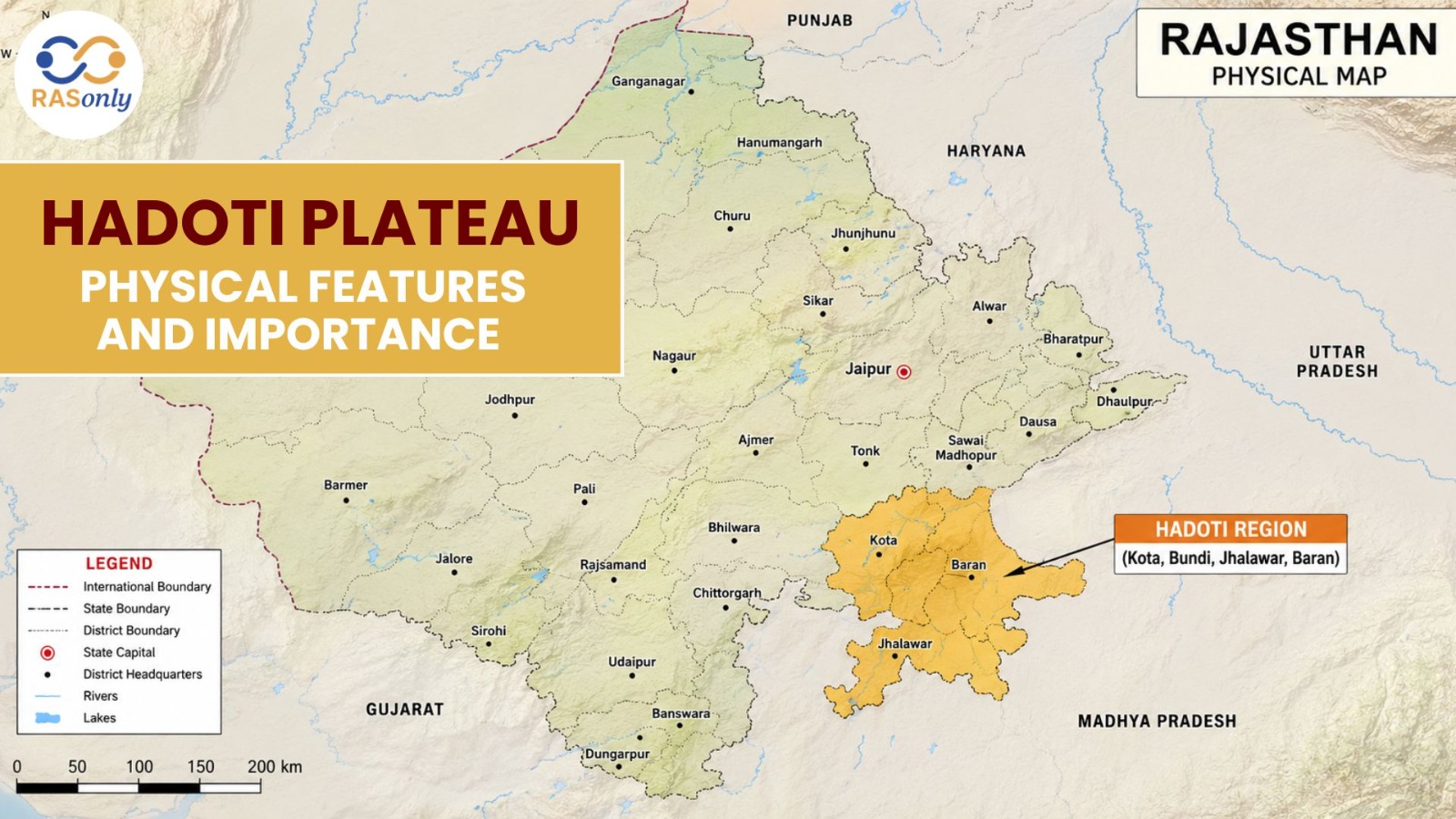
The Hadoti Plateau is a topic that cannot be missed when preparing for any exam conducted by the Rajasthan government, such as RAS, RPSC, and any other state-level exam. It appears in almost every year's Rajasthan GK papers as it is either a direct question or it is part of a question based on a river, soil, or wildlife. Everything about the Hadoti region (Physical features, formation, rivers, and importance) is explained in an easy-to-remember way before an exam.
What is the Hadoti Plateau?
The Hadoti Plateau is the south-eastern plateau of Rajasthan, and geographically, it's really the northern extension of the Malwa Plateau. The name "Hadoti" comes from the Hada Rajputs, who ruled over this region for centuries and left behind a strong cultural and architectural legacy that you still see in Kota and Bundi today.
Districts covered: Kota, Bundi, Jhalawar, and Baran form the core of this region.
Area: This plateau covers roughly 6.66% of Rajasthan's total geographical area — a small figure, but disproportionately important for the exam.
Physical Features of Hadoti Plateau
1. Formation and Rock Type
This is the single most-asked fact about Hadoti in exams: the plateau was formed by the Deccan Trap, meaning it's made of basalt rock created by volcanic activity millions of years ago. This volcanic origin is exactly why the soil here looks and behaves so differently from the rest of Rajasthan.
Because of this basaltic base, the region has developed black cotton soil, which is naturally rich in minerals and retains moisture far better than the sandy soils found elsewhere in the state.
2. Relief and Elevation
Hadoti is a dissected plateau, which means its surface isn't uniformly flat - it has been cut and shaped over time by rivers and erosion. General elevation ranges between 250 to 500 metres, with a mix of flat plains, valleys, and scattered hill ranges.
3. Major Hill Ranges
The Mukundara Hills, sitting on the Kota–Jhalawar border, are the most important hill range here and also home to the Mukundara Hills Tiger Reserve - a favourite exam reference point that links geography with wildlife conservation.
4. Rivers of the Hadoti Region
Hadoti is often called the "river region of Rajasthan" because so many major rivers flow through it:
- Chambal River - the largest and most important river of the region, on which the Rana Pratap Sagar, Jawahar Sagar, and Gandhi Sagar dams are built
- Kalisindh River
- Parvan River
- Aahu River
- Parwati River
The Chambal valley has also carved out deep ravines (locally called "beehad"), a classic example of erosional landforms that examiners love to reference.
5. Climate
The Hadoti region has a sub-humid climate, receiving more rainfall than most of Rajasthan - averaging 75 to 100 cm annually. This makes it one of the wettest zones in an otherwise arid state, which is exactly why it stands out in comparative climate questions.
Why Hadoti Plateau Matters (Importance)
Economic Importance
The black cotton soil here supports large-scale cultivation of soybean, cotton, coriander, garlic, and oranges - so much so that the Kota-Baran belt is often nicknamed the "Soybean Bowl of Rajasthan." The dams on the Chambal River also provide irrigation and hydroelectric power, which has turned Kota into a genuine industrial hub, particularly known for fertilizer and chemical manufacturing.
Ecological Importance
With the Mukundara Hills Tiger Reserve and Darrah Wildlife Sanctuary, this region plays a real role in biodiversity conservation. The dense forest cover here also helps maintain ecological balance across the state.
Historical and Tourism Importance
Kota, Bundi, and Jhalawar are known for their forts, stepwells (like Rani Ji Ki Baori), and palaces. Chambal River Safari and the gharial sanctuary have also made this a growing eco-tourism destination.
Exam Perspective - Why This Topic Is High-Yield
RAS exams frequently test candidates on:
- Districts included in the Hadoti Plateau
- Location and significance of the Mukundara Hills
- Names and sequence of dams built on the Chambal River
- Characteristics of black cotton soil and the crops it supports
- Facts related to the Deccan Trap formation
Quick Revision Table
| Point | Details |
|---|---|
| Location | South-eastern Rajasthan |
| Core Districts | Kota, Bundi, Jhalawar, Baran |
| Formation | Deccan Trap (basalt rock) |
| Soil Type | Black cotton soil |
| Main River | Chambal |
| Other Rivers | Kalisindh, Parvan, Aahu, Parwati |
| Major Hills | Mukundara Hills |
| Elevation | 250–500 metres |
| Climate | Sub-humid |
| Annual Rainfall | 75–100 cm |
| Main Crops | Soybean, cotton, coriander, garlic |
| Key Dams | Rana Pratap Sagar, Jawahar Sagar, Gandhi Sagar |
Conclusion
To sum up, the Hadoti Plateau stands out in Rajasthan's geography for its unique black cotton soil, Deccan Trap origin, and river-rich landscape formed by the Chambal, Kalisindh, and Parvan rivers. Its economic, ecological, and historical importance makes it a high-yield topic for every RAS aspirant. Revise the districts, dams, and Mukundara Hills carefully, since Hadoti Plateau questions appear consistently in Rajasthan GK papers year after year.
FAQs - Hadoti Plateau
It's the south-eastern plateau region of Rajasthan, covering Kota, Bundi, Jhalawar, and Baran districts, formed as a northern extension of the Malwa Plateau.
It combines geography, geology, river systems, and wildlife conservation into one topic, making it a recurring favorite in Rajasthan GK papers.
The Chambal, Kalisindh, Parvan, Aahu, and Parwati rivers all flow through this region.
Black cotton soil, formed from the weathering of basalt rock, is the dominant soil type here.
It was formed by the Deccan Trap - a large volcanic basalt formation created through ancient lava flows.

BEST SELLER
🏆 PRELIMS
RAS Pass
Prelims focused Hindi & English
₹399
✓
Prelims Topic-Wise Tests
✓
Subject-Wise Tests
✓
Full-Length Prelims Tests
✓
Daily Current Affairs Tests
✓
Prelims PYQs Tests
✓
Detailed Solutions & Analysis
✓
All Rajasthan Ranking
✓
Unlimited Reattempts
✓
Mains Tests
✓
Hindi & English Tests
✓
All Rajasthan Ranking
Trusted by 5,000+ Students
Post Category
- RAS Salary
- Result
- RAS Admit Card
- RAS Job
- RAS Cutoff
- Preparation Tips
- RAS Answer Key
- RAS Exam Analysis
- RAS Syllabus
- RAS Previous Year Papers
- RPSC RAS Exam Pattern
- RAS Interview
- RAS Exam Date
- RAS Vacancy
- RAS Test Series
- RAS Best Books
- RAS Preparation Resources
- RAS Coaching Centre
- History
- Polity
- Geography
- Economics
- Science
- Art and Culture
- RPSC RAS Application Form
- RPSC RAS Notification
- RAS Eligibility Criteria
- UPSC Exam
- RPSC RAS Mains
Visit Our RASonly Offline Center
Our Expert Faculty

Bhunesh Sir
Current Affairs · 13+ Yrs

Aamir Khan Sir
RAS-2017 · IIM Ahm.
Akash Sir
Polity · 8+ Yrs
Free Resources
Official Mobile App

RASOnly App
by OTSAdda · Free
Full Video Lectures
Mock Tests & PYQs
Daily Current Affairs
AI Mock Interview
Free Download · No subscription needed to install
RAS 2024 Toppers — RASonly
Rank 2
Virendra Charan
Rank 9
Bhoopinder Singh
Rank 26
Aanchal Nagpal
Rank 33
Lokendra Singh
Rank 45
Amar Rathore
Rank 46
Manasvini Verma

Join RASonly WhatsApp Community
Get daily current affairs, exam alerts, free study material and tips from expert faculty — right on WhatsApp.
Join for Free →RASonly Interview Guidance Program

Mr. Ashok Jain
Ex-Chief Secretary Govt of Rajasthan
- IAS officer of the 1981 batch, Rajasthan cadre.
- Passionate about mentoring the next generation of RAS officers with real-world insights.
- Got retired in Dec 2017 from the post of Chief Secretary of the state of Rajasthan.

Mr. Guru Charan Rai
Ex-ASP / SP in Jaisalmer
- Guru Charan Rai, IPS (Retd), retired as Inspector General of Police (Security), Rajasthan, Jaipur in 2017.
- Served as ASP and SP in Jaisalmer, Nagaur, Sri Ganganagar, Sawai Madhopur, Dausa, Sikar, and Karauli.
- He also held key positions as DIGP and IGP in the Law and Order division.

Mr. Rakesh Verma
Ex-IAS Officer, B.Tech, MBA, and M.A. (Economics)
- IAS officer of the 1981 batch and retired in Chief Secretary Rank.
- Civil servant of high repute and vast experience.
- Has been teaching UPSC CSE subjects for the last six years.

Daily Current Affairs for RAS Exam Preparation 2026

Niharika Rathore Wins MIS Global India Title
October 03, 2026
Rajasthan Achieves 90.19 Lakh Farmer ID Target
October 03, 2026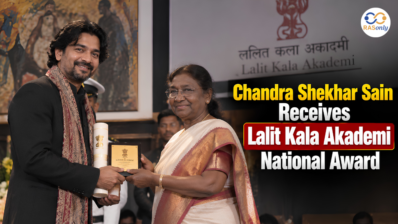
Chandra Shekhar Sain Receives Lalit Kala Akademi National Award
October 01, 2026