Central Information Commission (CIC), Power, RAS Notes
Water Resources of Rajasthan - Complete Notes for RAS

Get in Touch with RASonly!

Water Resources of Rajasthan form one of the most important and frequently tested topics for RAS aspirants, covering rivers, groundwater, and traditional harvesting systems. This complete guide explains the Chambal River, Johad, Tanka, Khadin, Baori, and the Indira Gandhi Canal Project in detail, along with the ongoing groundwater depletion crisis and key government policies like MJSA and Atal Bhujal Yojana. Ideal for both Prelims and Mains preparation, this article simplifies complex geography into exam-ready, structured notes with tables and quick-revision points for faster learning.

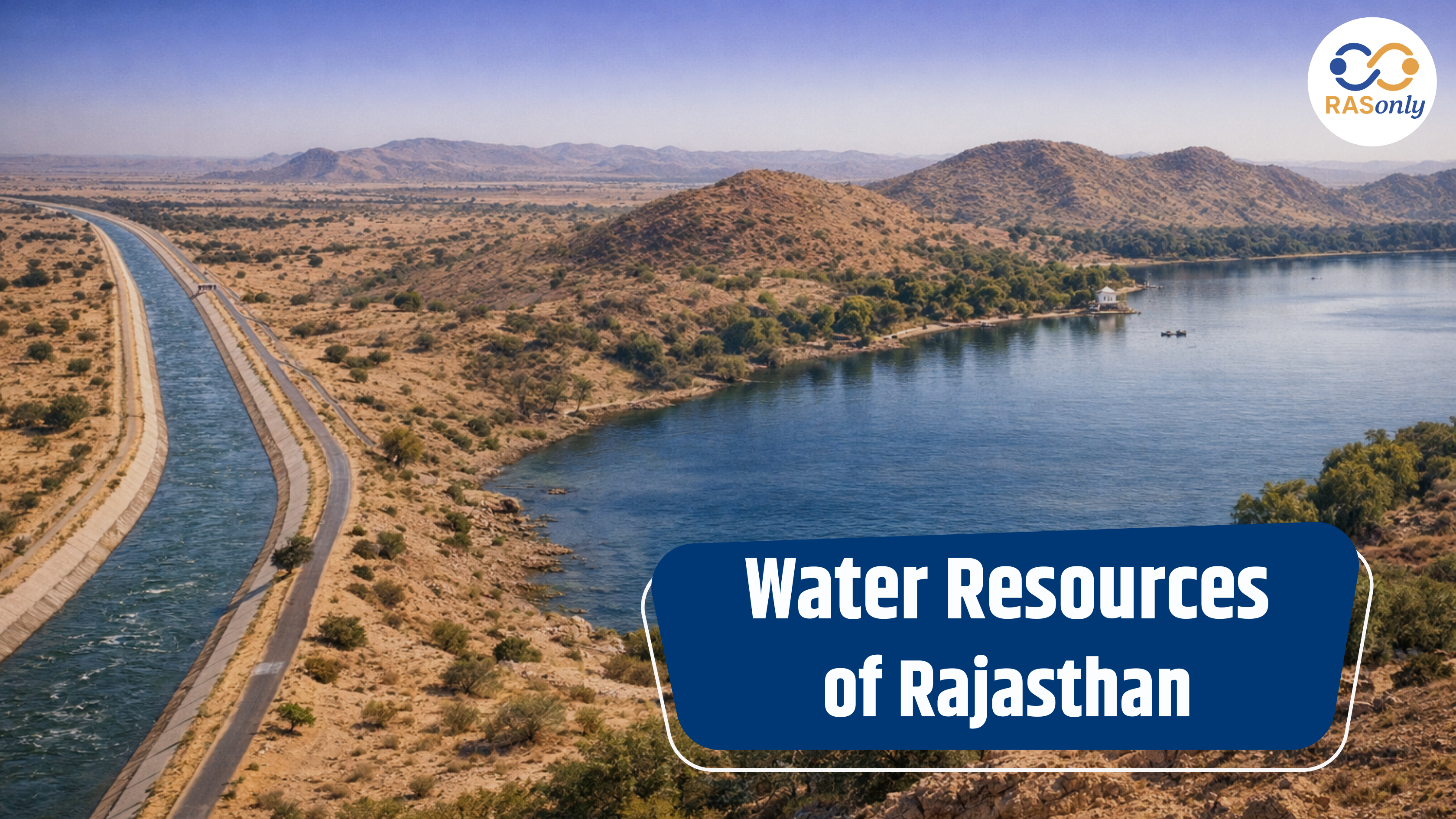
Rajasthan is India's largest state by area, but ironically it is also one of the most water-stressed regions in the country. Understanding the water resources of Rajasthan is essential for RAS aspirants because this topic connects geography, environment, governance, and current affairs all of which are frequently tested together in Prelims and Mains.
This article covers rivers, traditional water harvesting systems, canal projects, groundwater issues, and conservation policies in a structured, exam-ready format.
Introduction to Water Resources of Rajasthan
Rajasthan receives highly uneven and scanty rainfall, ranging from less than 100 mm in the western Thar Desert to over 600-650 mm in the southeastern parts near Mount Abu. Because of this imbalance, the state has historically depended on a mix of surface water, groundwater, and traditional water harvesting structures to meet its needs.
The water resources of Rajasthan can broadly be classified into three categories:
- Surface Water Resources – rivers, lakes, and canals
- Groundwater Resources – wells, tube wells, and aquifers
- Traditional Water Harvesting Systems – johad, tanka, khadin, baori, nadi
Each of these plays a different role depending on the region, the eastern part of Rajasthan relies more on rivers, while the western arid zone survives largely on traditional rainwater harvesting and groundwater.
Rivers of Rajasthan and Their Distribution
Rajasthan's rivers are unevenly distributed across the state. Broadly, they are divided into four drainage systems:
- Rivers flowing into the Arabian Sea (Luni system)
- Rivers flowing into the Bay of Bengal (Chambal, Banas system)
- Inland drainage rivers (rivers that disappear into the desert or salt lakes)
- Rivers that dry up seasonally
List of Rivers in Rajasthan and Their Tributaries
| River Name | Origin | Basin/Drainage | Key Feature |
|---|---|---|---|
| Chambal River | Janapav hills, Madhya Pradesh | Bay of Bengal system | Only perennial river of Rajasthan; Kota, Jawahar Sagar, Rana Pratap Sagar dams built on it |
| Banas River | Khamnor hills, near Kumbhalgarh | Tributary of Chambal | Called the "lifeline of Rajasthan" for southeastern districts |
| Luni River | Naga hills near Ajmer (Pushkar) | Arabian Sea system | Water becomes saline after Balotra; disappears into Rann of Kutch |
| Mahi River | Vindhya Range, MP | Bay of Bengal system | Flows through Banswara and Dungarpur; Mahi Bajaj Sagar Dam |
| Sabarmati River | Aravalli hills, Udaipur district | Arabian Sea system | Short course in Rajasthan before entering Gujarat |
| Ghaggar River | Shivalik hills, Himachal Pradesh | Inland drainage (lost river) | Known as "Nadi Nahin Jo Ghar Aati Hai"; disappears near Hanumangarh |
| Kantli River | Khandela hills, Sikar | Inland drainage | Non-perennial, feeds the Sambhar Lake basin |
This table is important for RAS Mains, since questions often ask candidates to match rivers with their origin, basin, or associated dam.
Traditional Water Harvesting Systems in Rajasthan
Long before modern irrigation projects, the people of Rajasthan developed indigenous water conservation techniques suited to the arid climate. These traditional water harvesting systems in Rajasthan remain highly relevant today for sustainable water management and are a favourite topic in RAS Mains answer writing.
Johad, Tanka, Khadin, Nadi, Baori - Difference Explained
| Structure | Region Common In | Purpose | Key Point |
|---|---|---|---|
| Johad | Alwar, Jaipur, Rajsamand | Rainwater harvesting for groundwater recharge | Earthen check dams; revived by Rajendra Singh, "Waterman of India" |
| Tanka | Jaisalmer, Barmer, Bikaner | Household drinking water storage | Underground covered cisterns; store rainwater collected from courtyards/roofs |
| Khadin | Jaisalmer | Agricultural water harvesting | Adapted from Persian "Karez" system; used for rain-fed farming |
| Nadi | Western Rajasthan (village ponds) | Community water source | Village-level ponds mainly for drinking and cattle |
| Baori/Bawari | Across Rajasthan | Water storage + social/religious use | Stepwells with intricate architecture, also used for community gatherings |
Key exam point: Traditional systems are considered more sustainable because they are decentralized, low-cost, and adapted to local ecology - unlike large canal projects which can lead to waterlogging and salinity.
Rajasthan Canal (Indira Gandhi Canal) Project
The Indira Gandhi Canal Project, earlier known as the Rajasthan Canal, is the largest canal irrigation project in India and has transformed the arid districts of northwestern Rajasthan.
Indira Gandhi Canal - Importance and Features
- Origin: Harike Barrage (confluence of Sutlej and Beas rivers, Punjab)
- Length: Around 649 km the longest canal in India
- Districts benefited: Ganganagar, Hanumangarh, Bikaner, Jaisalmer, Barmer
- Purpose: Irrigation, drinking water supply, and afforestation in desert areas
- Divided into two parts:
- Rajasthan Feeder Canal (from Harike to Masitawali head)
- Main Canal (from Masitawali head onwards, running through the desert)
Impact: The canal has converted large parts of the Thar Desert into agriculturally productive land, but it has also led to waterlogging and soil salinity in certain command areas a commonly asked critical-analysis point in RAS Mains.
Groundwater Resources and Depletion in Rajasthan
Groundwater is the backbone of water supply in most of Rajasthan, especially in the western and central districts where surface water is scarce. However, the state faces a serious groundwater depletion crisis.
Groundwater Crisis in Rajasthan - Causes and Solutions
| Causes of Groundwater Depletion | Possible Solutions |
|---|---|
| Over-extraction for irrigation (especially in eastern Rajasthan) | Promoting drip and sprinkler irrigation |
| Low and erratic rainfall | Reviving traditional water harvesting structures |
| Rising number of tube wells and borewells | Strict regulation of groundwater extraction |
| Cropping pattern favouring water-intensive crops | Crop diversification towards less water-intensive crops |
| Decline in traditional recharge structures | Mandatory rainwater harvesting in urban buildings |
According to Central Ground Water Board (CGWB) assessments, a large number of blocks in Rajasthan fall under the "over-exploited" or "critical" category, this is a frequently updated data point, so aspirants should check the latest CGWB report closer to their exam date.
Water Conservation Methods and Government Policies
To address the water crisis, both community-driven and government-led initiatives have been implemented across the state under the broader theme of water conservation methods in Rajasthan.
Rajasthan Water Resources Management Policy
- Mukhyamantri Jal Swavlamban Abhiyan (MJSA) - aimed at making villages self-sufficient in water through structure revival and rainwater harvesting
- Watershed Development Programmes - integrated soil and water conservation at the micro-watershed level
- PHED (Public Health Engineering Department) - nodal agency for drinking water supply in Rajasthan
- Atal Bhujal Yojana - community-led groundwater management scheme covering water-stressed districts of Rajasthan
- Rainwater Harvesting Mandate - compulsory in government and private buildings in urban areas
Note for Mains answer writing: Always link government schemes with traditional knowledge systems. RAS examiners value answers that show how modern policy is trying to revive or complement age-old practices like johad and khadin.
Water Resources of Rajasthan - Summary for RAS Exam
- Rajasthan has an uneven distribution of rivers, with the Chambal being the only perennial river.
- Traditional water harvesting systems (johad, tanka, khadin, nadi, baori) remain crucial due to arid conditions.
- The Indira Gandhi Canal is the state's largest irrigation project but comes with ecological trade-offs like waterlogging and salinity.
- Groundwater depletion is a major and worsening concern, especially in eastern and central districts.
- Government policies increasingly focus on combining modern schemes with traditional conservation wisdom.
Quick Revision Table
| Category | Examples | RAS Relevance |
|---|---|---|
| Perennial River | Chambal | Dam locations, hydro projects |
| Non-perennial/Saline River | Luni | Environmental geography |
| Traditional Structure | Johad, Tanka, Khadin | Sustainable development, Mains answer writing |
| Major Canal | Indira Gandhi Canal | Irrigation, agriculture, desert development |
| Government Scheme | MJSA, Atal Bhujal Yojana | Current affairs + governance |
This structure should give you a well-rounded, exam-focused understanding of the water resources of Rajasthan - covering geography, traditional knowledge, infrastructure, and policy, all of which RAS examiners tend to weave together in a single question.
Conclusion
The water resources of Rajasthan present a unique case study in how a state with limited rainfall and a large desert area has managed to sustain agriculture, drinking water supply, and ecological balance over centuries. From the perennial Chambal River in the south to the indigenous johad and tanka systems in the west, Rajasthan's water story is really a story of adaptation.
For RAS aspirants, this topic is not just about memorising river names or dam locations, it is about understanding the interconnection between geography, traditional wisdom, and modern policy. The Indira Gandhi Canal shows the benefits and the risks of large-scale water engineering, while the ongoing groundwater depletion crisis shows why traditional and community-based conservation methods are gaining renewed importance today. A well-rounded answer in Mains should always try to connect these dots, geography explaining the problem, history explaining the traditional solution, and current policy explaining the modern response.
Revising this topic along with current affairs (latest CGWB groundwater report, new government schemes, recent dam or canal news) will make your answers far more relevant and up to date.
FAQs on Water Resources of Rajasthan
The Chambal River is the only perennial river of Rajasthan, as it receives water throughout the year from rainfall in Madhya Pradesh's catchment area.
The Indira Gandhi Canal (formerly Rajasthan Canal) is the largest canal project, originating from the Harike Barrage in Punjab and running about 649 km through the state's desert districts.
A Johad is an earthen check dam used mainly for groundwater recharge in villages, while a Tanka is an underground covered cistern used to store rainwater for household drinking purposes, common in the Jaisalmer-Barmer region.
Rajasthan's rivers are unevenly distributed, and most regions, especially western and central districts, depend heavily on groundwater for irrigation and drinking. Over-extraction, low rainfall, and water-intensive cropping patterns have together caused a serious groundwater crisis in Rajasthan.
Khadin is a traditional agricultural water harvesting system, mainly used in Jaisalmer, where rainwater is trapped in fields using earthen embankments to support rain-fed farming in an otherwise arid region.
Key schemes include the Mukhyamantri Jal Swavlamban Abhiyan (MJSA), Atal Bhujal Yojana, and various watershed development programmes, all aimed at reviving traditional structures and promoting sustainable groundwater use.
While the canal has converted large parts of the Thar Desert into productive agricultural land and improved drinking water access, it has also caused waterlogging and soil salinity in several command areas, making it an important topic for critical analysis in RAS Mains.

BEST SELLER
🏆 PRELIMS
RAS Pass
Prelims focused Hindi & English
₹399
✓
Prelims Topic-Wise Tests
✓
Subject-Wise Tests
✓
Full-Length Prelims Tests
✓
Daily Current Affairs Tests
✓
Prelims PYQs Tests
✓
Detailed Solutions & Analysis
✓
All Rajasthan Ranking
✓
Unlimited Reattempts
✓
Mains Tests
✓
Hindi & English Tests
✓
All Rajasthan Ranking
Trusted by 5,000+ Students

Post Category
- RAS Salary
- Result
- RAS Admit Card
- RAS Job
- RAS Cutoff
- Preparation Tips
- RAS Answer Key
- RAS Exam Analysis
- RAS Syllabus
- RAS Previous Year Papers
- RPSC RAS Exam Pattern
- RAS Interview
- RAS Exam Date
- RAS Vacancy
- RAS Test Series
- RAS Best Books
- RAS Preparation Resources
- RAS Coaching Centre
- History
- Polity
- Geography
- Economics
- Science
- Art and Culture
- RPSC RAS Application Form
- RPSC RAS Notification
- RAS Eligibility Criteria
- UPSC Exam
- RPSC RAS Mains
Visit Our RASonly Offline Center
Our Expert Faculty

Bhunesh Sir
Current Affairs · 13+ Yrs

Aamir Khan Sir
RAS-2017 · IIM Ahm.

Akash Sir
Polity · 8+ Yrs
Free Resources
Official Mobile App

RASOnly App
by OTSAdda · Free
Full Video Lectures
Mock Tests & PYQs
Daily Current Affairs
AI Mock Interview
Free Download · No subscription needed to install
RAS 2024 Toppers — RASonly
Rank 2
Virendra Charan
Rank 9
Bhoopinder Singh
Rank 26
Aanchal Nagpal
Rank 33
Lokendra Singh
Rank 45
Amar Rathore
Rank 46
Manasvini Verma

Join RASonly WhatsApp Community
Get daily current affairs, exam alerts, free study material and tips from expert faculty — right on WhatsApp.
Join for Free →RASonly Interview Guidance Program

Mr. Ashok Jain
Ex-Chief Secretary Govt of Rajasthan
- IAS officer of the 1981 batch, Rajasthan cadre.
- Passionate about mentoring the next generation of RAS officers with real-world insights.
- Got retired in Dec 2017 from the post of Chief Secretary of the state of Rajasthan.

Mr. Guru Charan Rai
Ex-ASP / SP in Jaisalmer
- Guru Charan Rai, IPS (Retd), retired as Inspector General of Police (Security), Rajasthan, Jaipur in 2017.
- Served as ASP and SP in Jaisalmer, Nagaur, Sri Ganganagar, Sawai Madhopur, Dausa, Sikar, and Karauli.
- He also held key positions as DIGP and IGP in the Law and Order division.

Mr. Rakesh Verma
Ex-IAS Officer, B.Tech, MBA, and M.A. (Economics)
- IAS officer of the 1981 batch and retired in Chief Secretary Rank.
- Civil servant of high repute and vast experience.
- Has been teaching UPSC CSE subjects for the last six years.


Daily Current Affairs for RAS Exam Preparation 2026

Shyam Sunder Swami Wins Bronze at World Archery Para...
September 14, 2026
Viksit Bharat Jan Seva Abhiyan 2026
September 14, 2026
Rajasthan Universities in the QS World University Rankings 2027
September 12, 2026