Kushan Empire: History, Rulers, Administration, Economy, Art, Decline
Indira Gandhi Canal Project (IGNP): History, Route, Stages, Branches & Lift Canals Explained

Get in Touch with RASonly!

The Indira Gandhi Canal Project is one of India's most ambitious desert-development schemes, carrying Sutlej-Beas river water from Punjab's Harike Barrage deep into Rajasthan's Thar Desert. Originally called the Rajasthan Canal Project, it was renamed in 1984 in honor of Indira Gandhi. Spanning nine branches, seven lift canals, and two major construction stages, this canal transformed an arid, drought-prone region into one of India's most productive agricultural belts.

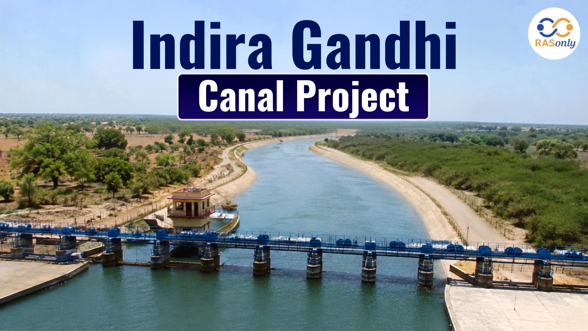
The Indira Gandhi Canal Project (IGNP), earlier known as the Rajasthan Canal Project (RCP), stands as one of independent India's most ambitious desert-development and irrigation schemes. Conceived to solve the chronic water scarcity of north-western Rajasthan, the canal carries the surplus waters of the Sutlej and Beas rivers from Punjab, across a short stretch of Haryana, and deep into the sand dunes of the Thar Desert. In doing so, it transformed a rain-starved, sparsely cultivated tract into one of the most productive agricultural belts of the state.
Popularly referred to as the "Ganga of the Desert" or Maru Ganga, the canal is not merely an irrigation channel - it is a lifeline that supplies drinking water to millions of people, supports livestock, sustains new townships, and has reshaped the demographic and economic map of western Rajasthan. For RAS aspirants, IGNP is a high-priority topic because it links Geography, Rajasthan-specific General Knowledge, Economy, and Environment sections of the syllabus simultaneously.
With a total command area extending across several districts and a canal network stretching for thousands of kilometers when all distributaries are counted, the project remains the longest canal system in India and a textbook case of inter-basin water transfer.
RAS Exam Note: IGNP questions are frequently asked in RAS Prelims under Rajasthan Geography and in Mains as an essay/analytical question on "Desert Development and Water Management in Rajasthan."
Historical Background and Conception
The idea of bringing Himalayan river water to the parched plains of western Rajasthan is nearly eight decades old. It was first conceived by Kanwar Sain, a distinguished hydraulic engineer, who submitted a detailed report titled "Requirement of Water for the State of Bikaner" to the Government of India. Following years of inter-state negotiation over river-water sharing between Punjab, Rajasthan, and the princely states, construction finally began in the early 1950s.
The foundation stone of the project was laid by the then Union Home Minister, and the canal was originally named the Rajasthan Canal. It was renamed in honour of Prime Minister Indira Gandhi following her assassination in 1984, in recognition of the political and administrative push she gave to the project during her tenure.
| Year / Date | Event |
|---|---|
| 1948 | Kanwar Sain conceives the project and submits his report on Bikaner's water requirement. |
| 1951 | Central Water and Power Commission takes up the project for detailed planning. |
| 1952 | Actual construction work begins under the name Rajasthan Canal Project. |
| 31 March 1958 | Foundation stone formally laid by the Union Home Minister, Govind Ballabh Pant. |
| 1983–86 | Stage I construction substantially completed, over two decades behind the original schedule. |
| 2 November 1984 | Renamed the Indira Gandhi Canal in memory of Indira Gandhi. |
| 1 January 1987 | Water released up to the tail of the main canal near Mohangarh, Jaisalmer. |
| 2010 (approx.) | Major distributary and lift-canal works of Stage II substantially completed. |
Objectives of the Project
IGNP was designed as a multi-purpose desert-development scheme rather than a simple irrigation channel. Its core objectives include:
- Providing perennial irrigation to the drought-prone districts of north-western Rajasthan, converting arid and semi-arid land into cultivable area.
- Supplying safe drinking water to towns and villages across the Thar region, where groundwater is scarce and often saline.
- Controlling and reversing desertification by stabilising sand dunes through the spread of vegetation and cropping.
- Supporting allied activities such as animal husbandry, fisheries in canal reservoirs, and rural industry.
- Facilitating planned resettlement and the growth of new agricultural colonies along the canal command area.
- Strengthening the socio-economic and strategic profile of the India–Pakistan border belt, since the canal runs roughly parallel to the international border.
Origin and Course of the Canal
The Indira Gandhi Canal originates at the Harike Barrage in Punjab, which is built at the confluence of the Sutlej and Beas rivers. From this point, the canal travels briefly through the north-western corner of Haryana before entering Rajasthan near Hanumangarh district, and finally terminates deep in the Thar Desert near Gadra Road in Barmer district, flowing roughly parallel to the India–Pakistan border throughout its Rajasthan stretch.
Engineers divide the canal's course into four functional sections, each with its own name, direction of flow, and length. The table below summarises this structure, which is one of the most frequently tested facts in RAS Geography questions.
| Section | Stretch | Approx. Length | Flow Direction |
|---|---|---|---|
| Rajasthan Feeder Canal (RF Canal) | Harike Barrage (Punjab) → Masitawali (Hanumangarh) | 204 km | North to South-West |
| Indira Gandhi Main Canal (IGM Canal) | Masitawali → Mohangarh (Jaisalmer) | 445 km | North to South-West |
| Sagarmal Gopa Branch Canal (SGB Canal) | Mohangarh → Gunjangarh–Ramgarh (Jaisalmer) | 96 km | East to West |
| Baba Ramdev Sub-Branch Canal (BRSB Canal) | Extends further towards Gadra Road, Barmer | Remaining stretch of total course | South-West |
Taken together, the main course of the canal (RF + IGM + SGB + BRSB) stretches for roughly 837 km, making it the longest canal in India. If the entire network of branches, distributaries, and minors is included, the system extends to several thousand kilometres — figures cited by different sources range from about 8,000 to over 9,000 km, since new distributaries have been added in phases over the decades.
Branches (Shakhayein) of the Main Canal
From the main line of the canal, nine distributary branches (locally called Shakhayein) take off to spread water sideways into the command area. A distinctive and frequently tested fact is that eight of these nine branches emerge from the right bank of the canal, while only the very first branch — the Rawatsar Branch — emerges from the left bank. This asymmetry occurs because the natural slope of the land in this part of Rajasthan falls from south-east to north-west, so gravity carries water more easily to the right side.
| # | Branch Name | District(s) Served | Distinguishing Fact |
|---|---|---|---|
| 1 | Rawatsar Branch | Hanumangarh | First branch of IGNP; the only branch on the left bank of the canal. |
| 2 | Suratgarh Branch | Sri Ganganagar | One of the branches with a small hydel (power) house. |
| 3 | Anupgarh Branch | Sri Ganganagar | Also has a minor hydel power installation. |
| 4 | Pugal Branch | Bikaner | Marks roughly the end point of Stage I of the project. |
| 5 | Datore Branch | Bikaner | Lies in the northern part of Bikaner district. |
| 6 | Birsalpur Branch | Bikaner | Has a small hydel power house. |
| 7 | Charanwala Branch | Bikaner & Jaisalmer | Only branch that extends across two districts. |
| 8 | Shahid Birbal Branch | Jaisalmer | Named in memory of a martyr; serves the Jaisalmer command area. |
| 9 | Sagarmal Gopa Branch | Jaisalmer | Southern-most branch, named after freedom fighter Sagarmal Gopa. |
RAS Exam Note: Minor hydro-power houses of about 24 MW combined capacity have been set up on the Suratgarh, Anupgarh, Pugal, and Birsalpur branches - a fact commonly asked in RAS Prelims.
Development in Two Stages
Given the enormous scale of the project, IGNP was implemented in two administrative stages, each targeting a different terrain type and irrigation technique. Stage I relied mainly on gravity flow across relatively flat land, while Stage II had to overcome higher and undulating desert terrain, requiring an elaborate system of lift canals to raise water against elevation.
Stage I
- Covers the Rajasthan Feeder Canal (204 km) and the upper part of the Main Canal up to Pugal, Bikaner (189 km) - a combined 393 km stretch.
- Command area lies mainly in Sri Ganganagar, Hanumangarh, and the northern part of Bikaner district.
- Relies predominantly on gravity-based flow irrigation due to comparatively flat terrain.
- Culturable Command Area (CCA) of approximately 5.53 lakh hectares.
- Substantially completed by 1983–86, though well behind the original schedule.
- Transformed Sri Ganganagar into what is popularly called the "Food Basket of Rajasthan" due to high wheat, cotton, and mustard yields.
Stage II
- Extends the Main Canal by a further 256 km, from Pugal (Bikaner) to Mohangarh (Jaisalmer), and onward through the SGB and BRSB canals towards Gadra Road, Barmer.
- Covers the higher, dune-dominated terrain of Bikaner, Jaisalmer, Jodhpur, Churu, and Barmer districts.
- Required the construction of several lift canals - including the Kanwar Sain, Chaudhary Kumbharam Arya, Panna Lal, Veer Tejaji, and Jai Narayan Vyas lift schemes - to raise water to elevated command areas.
- Culturable Command Area (CCA) of approximately 14.10 lakh hectares.
- Main canal work completed around 1986, with distributary and lift-canal works extending well into the 2000s.
| Feature | Stage I | Stage II |
|---|---|---|
| Terrain | Comparatively flat | High, undulating, dune-dominated |
| Irrigation Method | Mainly gravity flow | Gravity + Lift irrigation |
| Main Districts Covered | Sri Ganganagar, Hanumangarh, North Bikaner | Bikaner, Jaisalmer, Jodhpur, Churu, Barmer |
| Approx. CCA | 5.53 lakh hectares | 14.10 lakh hectares |
| Canal Length (Main Line) | 393 km (Feeder 204 km + Main 189 km) | 256 km (Pugal to Mohangarh) + branches |
| Completion | 1983–86 | Main canal completed in 1986; full network completed later |
RAS Exam Note: Remember the split with the phrase "Feeder 204 + 189 = Stage I ends at Pugal; next 256 km to Mohangarh = Stage II." Total main + feeder line to Mohangarh works out to about 649 km.
Districts and Area Covered
The canal's command area spans several districts of north-western Rajasthan, running as a green ribbon through what was once one of the driest parts of the country. While the exact list varies slightly by source depending on whether only the main command area or all lift-scheme extensions are counted, the following districts are consistently associated with IGNP:
| District | Nature of Benefit |
|---|---|
| Sri Ganganagar | Primary Stage I command area; intensive wheat, cotton, and mustard cultivation. |
| Hanumangarh | Stage I command area; canal enters Rajasthan here via the Rajasthan Feeder (RF) Canal. |
| Bikaner | Benefits from both stages; northern part under gravity flow, southern part under lift irrigation schemes. |
| Jaisalmer | Stage II command area; served by the Sagarmal Gopa Branch (SGB) and Baba Ramdev Sub-Branch (BRSB) canals, transforming desert land into farmland. |
| Barmer | Tail-end of the canal system near Gadra Road; receives drinking water and limited irrigation benefits. |
| Jodhpur | Benefits mainly through lift canals and drinking water supply schemes. |
| Churu | Covered through the Chaudhary Kumbharam Arya Lift Canal. |
| Nagaur | Covered through the Panna Lal Lift Canal for irrigation and drinking water supply. |
Beyond irrigation, the canal has become the principal source of piped drinking water for a large population across these border districts, supplying water to numerous towns and hundreds of villages through schemes such as the Aapni Yojna.
Lift Canals of Stage II
Since much of Stage II's command area lies at a higher elevation than the main canal, water has to be mechanically lifted before it can flow onward by gravity. A total of seven lift canals were built for this purpose, and all seven lie on the left bank of the canal - the reverse of the branch pattern - because the land on the left side is comparatively higher and does not receive water by gravity alone. Together, these seven lift canals (including their sub-branches) run for a combined length of about 1,495 km and contribute roughly 30% of IGNP's total irrigation, with the remaining 70% coming through the gravity-fed branches.
| # | Lift Canal (Current Name) | Old / Original Name | District(s) Served | Key Fact |
|---|---|---|---|---|
| 1 | Chaudhary Kumbharam Arya Lift Canal (Aapni Yojna) | Gandheli–Sahwa Lift | Hanumangarh, Churu, Jhunjhunu, Bikaner | Spans the most districts among all seven lift canals; developed with German collaboration under the Aapni Yojna. |
| 2 | Kanwarsen Lift Canal | Lunkaransar Lift | Sri Ganganagar, Bikaner | The first lift canal built and the longest single lift canal (approx. 151.64 km); known as the lifeline of Bikaner city. |
| 3 | Panna Lal Barupal Lift Canal | Gajner Lift | Nagaur, Bikaner | Supplies water to the Jayal defluoridation drinking-water scheme in Nagaur. |
| 4 | Veer Tejaji Lift Canal | Bangarsar Lift | Bikaner | The shortest lift canal among the seven. |
| 5 | Dr. Karni Singh Lift Canal | Kolayat Lift | Bikaner, Jodhpur | Extends water supply into the northern part of Jodhpur district. |
| 6 | Guru Jambheshwar Lift Canal | Phalodi Lift | Jodhpur, Jaisalmer, Bikaner | Named after Guru Jambheshwar, the founder of the Bishnoi sect. |
| 7 | Jai Narayan Vyas Lift Canal | Pokaran Lift | Jaisalmer, Jodhpur | Named after the third Chief Minister of Rajasthan and serves the Pokaran region. |
| Quick Fact | Lift Canal |
|---|---|
| Most districts covered | Chaudhary Kumbharam Arya Lift Canal |
| First & longest single lift canal | Kanwarsen Lift Canal (≈151.64 km) |
| Shortest lift canal | Veer Tejaji Lift Canal |
| Total length of all lift canals | ≈ 1,495 km |
| Share of irrigation via lift canals | ≈ 30% (remaining 70% via branch canals) |
Significance and Benefits
The economic and social impact of IGNP on western Rajasthan can hardly be overstated. Areas that were once dependent entirely on unpredictable monsoon rain and deep, often brackish groundwater now support settled, irrigated agriculture and growing townships.
Agricultural Transformation
- Introduced water-intensive but high-value crops such as wheat, cotton, mustard, and groundnut in a region earlier suited only to hardy, drought-resistant crops like bajra and guar.
- Sri Ganganagar and Hanumangarh now rank among the highest-yielding agricultural districts in Rajasthan.
- Enabled multiple cropping in areas where a single rain-fed crop was previously the norm.
Drinking Water Security
- Serves as the principal source of drinking water for a large population across eight border districts of western Rajasthan.
- Reduced dependence on saline groundwater, improving public health outcomes in the canal command belt.
Economic and Social Development
- Boosted rural incomes and reduced distress migration from the desert districts.
- Supported the growth of agro-based industries, mandis (market yards), and allied sectors like dairy and poultry.
- Contributes thousands of crores annually to Rajasthan's agricultural economy.
Strategic and Ecological Role
- Running close to the India–Pakistan border, the canal has supported settlement and economic activity in a strategically sensitive frontier zone.
- Has partially checked the eastward advance of the Thar Desert by stabilizing dunes with new vegetation cover.
Challenges and Environmental Concerns
Despite its transformative benefits, decades of canal irrigation in a fragile desert ecosystem have also produced significant problems, many of which remain live policy issues and are important from an analytical/Mains-answer perspective.
| Issue | Explanation |
|---|---|
| Waterlogging | Over-irrigation combined with poor natural drainage has raised the water table in several command areas, damaging soil structure. |
| Soil Salinity and Alkalinity | Rising water tables draw dissolved salts to the surface, reducing soil fertility in patches of the command area. |
| Seepage Losses | Large stretches of unlined or ageing canal sections lose significant water to seepage before it reaches the fields. |
| Inequitable Water Distribution | Head-reach farmers (near the canal's start) often receive more water than tail-end farmers, creating regional disparities. |
| Ecological Disruption | Introduction of surface water has altered local flora and fauna patterns, attracting new species while disturbing some native desert ecosystems. |
| Cross-Border Sensitivities | The canal's proximity to the international border adds security and maintenance considerations to routine operations. |
| Ageing Infrastructure | Portions of the canal built decades ago require repeated relining, desilting, and structural repair. |
Rajasthan's water resources department has responded with measures such as canal lining to cut seepage, construction of drainage channels to manage waterlogged patches, and promotion of micro-irrigation (drip and sprinkler systems) in the lift-canal command areas to use water more efficiently.
Recent Developments
- SCADA (Supervisory Control and Data Acquisition) systems have been progressively installed for real-time monitoring of water levels, remote gate control, and more transparent water distribution across the network.
- Pilot and expanding sprinkler-irrigation projects are being implemented in Stage II lift-scheme command areas to improve water-use efficiency on higher, sandier land.
- Periodic emergency water releases have been made to secure drinking-water supply for border districts during periods of heightened regional tension or acute shortage.
- Ongoing modernisation includes canal relining, desilting drives, and drainage-network expansion to tackle waterlogging and salinity in older command areas.
Quick Revision - Facts at a Glance
| Parameter | Detail |
|---|---|
| Original Name | Rajasthan Canal Project (RCP) |
| Renamed | 2 November 1984, after Indira Gandhi |
| Conceived By | Kanwar Sain (1948) |
| Foundation Stone | 31 March 1958, by Govind Ballabh Pant |
| Origin | Harike Barrage, Punjab (confluence of Sutlej and Beas) |
| Terminus | Near Gadra Road, Barmer district, Thar Desert |
| Main Sections | RF Canal (204 km), IGM Canal (445 km), SGB Canal (96 km), BRSB Canal |
| Total Main Course Length | ≈ 649 km (Feeder + Main to Mohangarh); ≈ 837 km including SGB & BRSB |
| Stage I CCA | ≈ 5.53 lakh hectares |
| Stage II CCA | ≈ 14.10 lakh hectares |
| Total Project CCA | ≈ 19.63 lakh hectares |
| Key Lift Canals | Kanwar Sen, Kumbha Ram Arya, Panna Lal, Veer Tejaji, Jai Narayan Vyas |
| Popular Name | Maru Ganga / Ganga of the Desert |
| Major Command Districts | Sri Ganganagar, Hanumangarh, Bikaner, Jaisalmer, Barmer, Jodhpur, Churu, Nagaur |
Conclusion
The Indira Gandhi Canal Project remains one of the most consequential water-engineering achievements in India's post-independence history. By channelling Himalayan river water across hundreds of kilometres into the heart of the Thar Desert, it has redrawn the agricultural, demographic, and strategic map of western Rajasthan. At the same time, its story is a reminder that large-scale water transfer projects bring their own long-term management challenges - waterlogging, salinity, and equitable distribution among them - which require continuous engineering and policy attention.
For RAS aspirants, IGNP offers a rich, interconnected case study spanning Geography, Economy, Environment, and Rajasthan-specific governance, making a thorough, fact-based understanding of its history, route, stages, and impact essential for both Prelims and Mains preparation.
FAQs
The Indira Gandhi Canal Project is a large-scale irrigation and drinking-water scheme that carries surplus water from the Sutlej and Beas rivers, via the Harike Barrage in Punjab, into the arid districts of north-western Rajasthan. Originally known as the Rajasthan Canal Project, it was renamed in 1984 in memory of Prime Minister Indira Gandhi.
The canal originates at the Harike Barrage in Punjab, at the confluence of the Sutlej and Beas rivers. It flows through a short stretch of Haryana, enters Rajasthan near Hanumangarh, and terminates near Gadra Road in Barmer district, deep in the Thar Desert.
The main course of the canal (Feeder + Main Canal to Mohangarh) is approximately 649 km. Including the Sagarmal Gopa and Baba Ramdev sub-branch canals, the total main course extends to about 837 km, making it the longest canal in India.
IGNP has nine distributary branches, of which only the Rawatsar Branch lies on the left bank while the remaining eight lie on the right bank. It also has seven lift canals, all located on the left bank, with a combined length of about 1,495 km.
Stage I covers the Rajasthan Feeder Canal and the upper Main Canal up to Pugal (Bikaner), relying mainly on gravity flow across flat terrain, with a Culturable Command Area (CCA) of about 5.53 lakh hectares. Stage II extends the canal to Mohangarh (Jaisalmer) and beyond, using lift canals to irrigate higher, dune-dominated terrain, with a CCA of about 14.10 lakh hectares.
BEST SELLER
🏆 PRELIMS
RAS Pass
Prelims focused Hindi & English
₹399
✓
Prelims Topic-Wise Tests
✓
Subject-Wise Tests
✓
Full-Length Prelims Tests
✓
Daily Current Affairs Tests
✓
Prelims PYQs Tests
✓
Detailed Solutions & Analysis
✓
All Rajasthan Ranking
✓
Unlimited Reattempts
✓
Mains Tests
✓
Hindi & English Tests
✓
All Rajasthan Ranking
Trusted by 5,000+ Students

Post Category
- RAS Salary
- Result
- RAS Admit Card
- RAS Job
- RAS Cutoff
- Preparation Tips
- RAS Answer Key
- RAS Exam Analysis
- RAS Syllabus
- RAS Previous Year Papers
- RPSC RAS Exam Pattern
- RAS Interview
- RAS Exam Date
- RAS Vacancy
- RAS Test Series
- RAS Best Books
- RAS Preparation Resources
- RAS Coaching Centre
- History
- Polity
- Geography
- Economics
- Science
- Art and Culture
- RPSC RAS Application Form
- RPSC RAS Notification
- RAS Eligibility Criteria
- UPSC Exam
- RPSC RAS Mains
Visit Our RASonly Offline Center
Our Expert Faculty

Bhunesh Sir
Current Affairs · 13+ Yrs

Aamir Khan Sir
RAS-2017 · IIM Ahm.

Akash Sir
Polity · 8+ Yrs
Free Resources
Official Mobile App

RASOnly App
by OTSAdda · Free
Full Video Lectures
Mock Tests & PYQs
Daily Current Affairs
AI Mock Interview
Free Download · No subscription needed to install
RAS 2024 Toppers — RASonly
Rank 2
Virendra Charan
Rank 9
Bhoopinder Singh
Rank 26
Aanchal Nagpal
Rank 33
Lokendra Singh
Rank 45
Amar Rathore
Rank 46
Manasvini Verma

Join RASonly WhatsApp Community
Get daily current affairs, exam alerts, free study material and tips from expert faculty — right on WhatsApp.
Join for Free →RASonly Interview Guidance Program

Mr. Ashok Jain
Ex-Chief Secretary Govt of Rajasthan
- IAS officer of the 1981 batch, Rajasthan cadre.
- Passionate about mentoring the next generation of RAS officers with real-world insights.
- Got retired in Dec 2017 from the post of Chief Secretary of the state of Rajasthan.

Mr. Guru Charan Rai
Ex-ASP / SP in Jaisalmer
- Guru Charan Rai, IPS (Retd), retired as Inspector General of Police (Security), Rajasthan, Jaipur in 2017.
- Served as ASP and SP in Jaisalmer, Nagaur, Sri Ganganagar, Sawai Madhopur, Dausa, Sikar, and Karauli.
- He also held key positions as DIGP and IGP in the Law and Order division.

Mr. Rakesh Verma
Ex-IAS Officer, B.Tech, MBA, and M.A. (Economics)
- IAS officer of the 1981 batch and retired in Chief Secretary Rank.
- Civil servant of high repute and vast experience.
- Has been teaching UPSC CSE subjects for the last six years.


Daily Current Affairs for RAS Exam Preparation 2026

Chandra Shekhar Sain Receives Lalit Kala Akademi National Award
October 01, 2026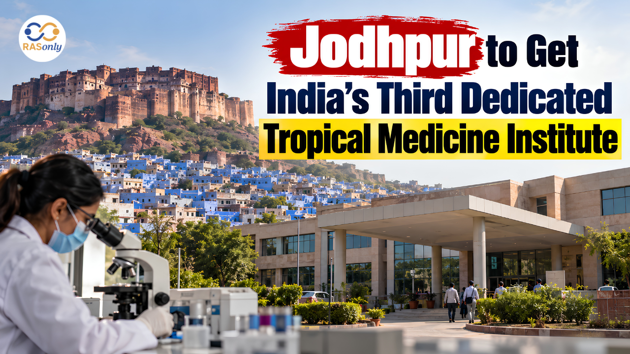
Jodhpur to Get India’s Third Dedicated Tropical Medicine Institute
October 01, 2026
Establishment of the Aesthetic Office
September 30, 2026