Gupta Empire, Founder, Time Period, Rulers, Map, Capital City
Agriculture and Agro-Climatic Zones of Rajasthan

Get in Touch with RASonly!

Agro-Climatic Zones of Rajasthan shape everything about how the state farms its land. Stretching from the sun-baked dunes of the Thar Desert to the rain-fed plains of Hadoti, Rajasthan's ten distinct zones each carry their own rainfall pattern, soil type, and cropping story. This guide breaks down every zone in detail - with districts, rainfall data, and major crops - making it a must-read for RAS aspirants, students, and anyone curious about how geography quietly runs the state's agriculture.

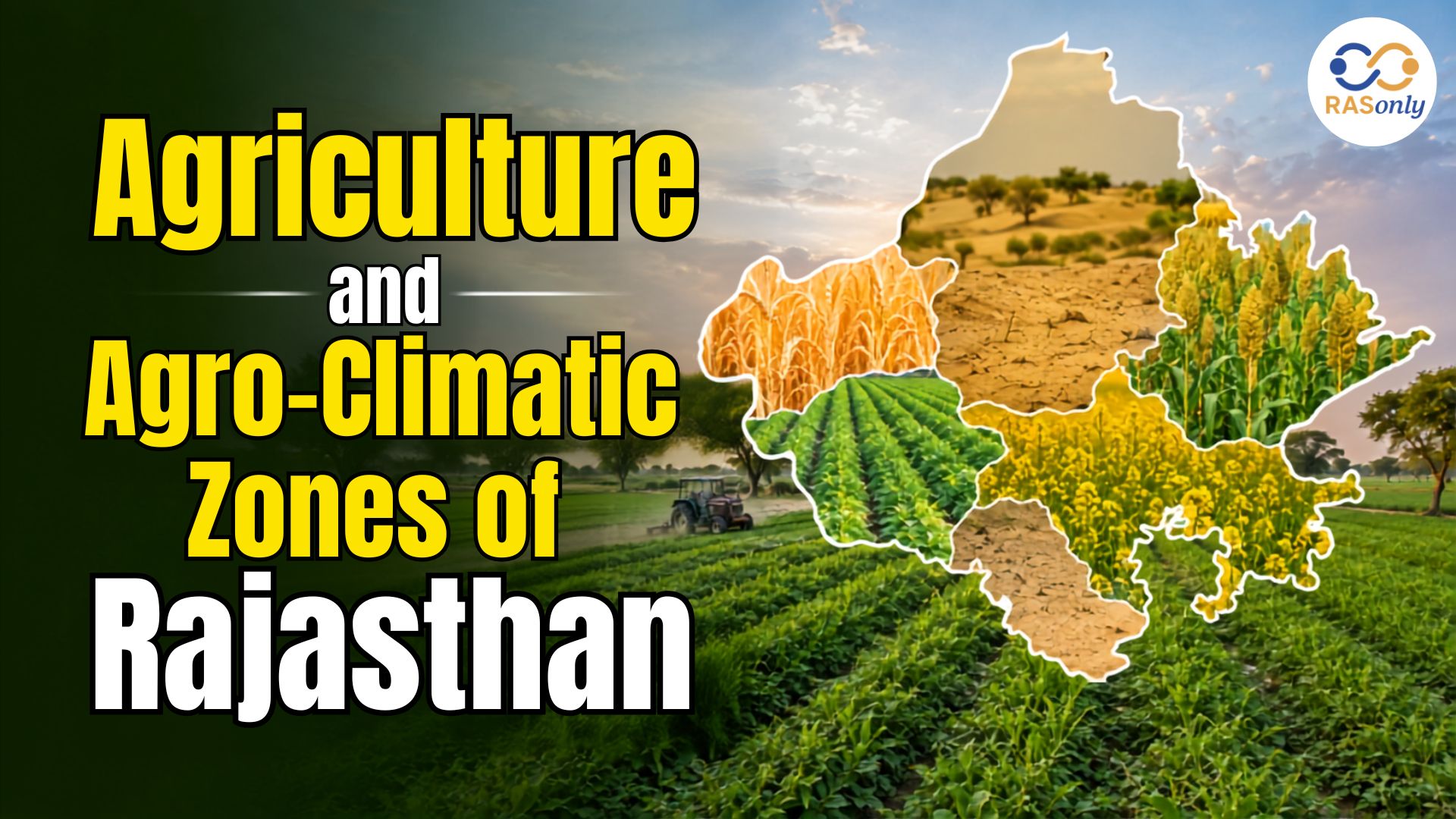
Rajasthan is India's largest state by area, and its agriculture tells a story of resilience. From the scorching sand dunes of the Thar Desert to the fertile, rain-fed plains of Kota and Bundi, farmers here have learned to work with - not against - a landscape of extremes. This diversity in rainfall, soil, and temperature is exactly why the state has been divided into distinct agro-climatic zones, a classification that guides everything from crop selection to irrigation policy and government subsidy planning.
Understanding these zones is not just useful for farmers and policymakers; it is also a frequently tested topic in the RAS (Rajasthan Administrative Service) examination and other state-level competitive exams. This guide breaks down Rajasthan's agriculture and its agro-climatic zones in a simple, structured, and exam-friendly way, with tables, key facts, and everything you need to build a strong foundation on the topic.
What Are Agro-Climatic Zones?
An agro-climatic zone is a geographical unit that shares broadly similar climate, soil, and topography, making it suitable for a similar set of crops and farming practices. In simple terms, it is a way of grouping land not by district or administrative boundary but by what nature has given it - rainfall, temperature, and soil type.
At the national level, the Planning Commission (now NITI Aayog) divided India into 15 broad agro-climatic zones based on factors like soil type, climate, and water availability. Rajasthan falls partly under Zone VI (Trans-Gangetic Plains), Zone VIII (Central Plateau and Hills), and Zone XIV (Western Dry Region). Within the state itself, a more detailed classification was developed for local agricultural planning.
How Rajasthan's Zones Were Classified
In 1979, the Indian Council of Agricultural Research (ICAR), along with the Rajasthan Agriculture University, divided the state into 10 agro-climatic zones, based on rainfall pattern, soil composition, and topography. This 10-zone framework has remained the standard reference for agricultural planning, research, and academic study for over four decades, and it is this classification that RAS and other competitive exams typically test.
- Basis of classification: rainfall, soil type, temperature range, and topography
- Total zones: 10 (numbered I-A to V)
- Purpose: crop planning, irrigation strategy, MSP procurement, and drought management
- Nodal body: Rajasthan Agriculture University (now Agriculture University, Jodhpur/Bikaner) in coordination with ICAR
Geographical Backdrop: Why Rajasthan's Agriculture Varies So Much
The Aravalli Range, one of the oldest fold mountain systems in the world, runs diagonally across Rajasthan from southwest to northeast. This single geographical feature splits the state into two very different agricultural worlds. To its west lies the arid and semi-arid Thar Desert region, with scanty rainfall, sandy soils, and a heavy dependence on groundwater and canal irrigation. To its east and south lie the more fertile plains and plateau regions, which receive better rainfall and support intensive cropping.
Rainfall in Rajasthan increases sharply as one moves from the north-west towards the south-east - from barely 100 mm a year near Jaisalmer and Bikaner to nearly 900-1000 mm in parts of Banswara and Udaipur. This single gradient, more than anything else, explains why the state needed a zone-wise approach to agricultural planning rather than a one-size-fits-all policy.
The 10 Agro-Climatic Zones of Rajasthan
Here is a consolidated, exam-ready table of all 10 agro-climatic zones of Rajasthan, along with the districts they cover, average rainfall, dominant soil type, and major crops grown in each.
| Zone | Name | Districts Covered | Avg. Rainfall | Major Crops |
|---|---|---|---|---|
| I-A | Arid Western Plain | Barmer, parts of Jodhpur | 200–370 mm | Bajra, Moth, Sesame / Wheat, Mustard, Cumin |
| I-B | Irrigated North-Western Plain | Sriganganagar, Hanumangarh | 100–350 mm | Cotton, Guar / Wheat, Mustard, Gram |
| I-C | Hyper Arid Partial Irrigated Zone | Bikaner, Churu, Jaisalmer | 100–270 mm | Bajra, Moth / Wheat, Gram, Mustard |
| II-A | Transitional Plain of Inland Drainage (Shekhawati) | Sikar, Jhunjhunu, Nagaur, Churu | 350–450 mm | Bajra, Groundnut / Wheat, Mustard |
| II-B | Transitional Plain of Luni Basin | Jalore, Pali, parts of Sirohi & Jodhpur | 300–500 mm | Bajra, Moth, Guar / Wheat, Gram |
| III-A | Semi-Arid Eastern Plain | Jaipur, Ajmer, Dausa, Tonk | 500–600 mm | Bajra, Groundnut / Wheat, Mustard, Barley |
| III-B | Flood-Prone Eastern Plain | Alwar, Bharatpur, Dholpur | 550–650 mm | Bajra, Jowar / Mustard, Wheat |
| IV-A | Sub-Humid Southern Plain | Udaipur, Chittorgarh, Rajsamand, Bhilwara | 600–900 mm | Maize, Soybean / Wheat, Gram |
| IV-B | Humid Southern Plain | Dungarpur, Banswara | 700–1000 mm | Maize, Paddy / Wheat, Gram |
| V | Humid South-Eastern Plain (Hadoti) | Kota, Bundi, Baran, Jhalawar | 650–900 mm | Soybean, Maize, Jowar / Wheat, Gram, Mustard |
Zone-Wise Details: A Closer Look
1. Western Arid and Desert Zones (I-A, I-B, I-C)
This belt, covering Barmer, Jaisalmer, Bikaner, Churu, Sriganganagar, and Hanumangarh, is Rajasthan's true desert country. Rainfall is scanty and erratic, soils are sandy and often calcareous, and groundwater is deep and frequently saline. Yet this is also where the Indira Gandhi Canal has transformed agriculture - the Irrigated North-Western Plain (Zone I-B) is now one of the state's most productive belts, often called the 'granary of Rajasthan' because of its wheat and cotton output. Away from the canal command area, farming still depends heavily on the monsoon, and drought-resistant crops like bajra (pearl millet) and moth bean dominate.
2. Transitional Zones (II-A, II-B)
These zones act as a bridge between the arid west and the more fertile east. The Shekhawati region (Sikar, Jhunjhunu, Nagaur, Churu) falls under Zone II-A and is known for its internal drainage - rainwater here does not flow out to the sea but collects in local depressions. Zone II-B, the Transitional Plain of the Luni Basin, is drained by the Luni river, Rajasthan's only significant west-flowing river, which eventually loses itself in the salt marshes of the Rann of Kutch.
3. Eastern Plains (III-A, III-B)
Moving east of the Aravallis, rainfall improves noticeably. The Semi-Arid Eastern Plain (Zone III-A), covering Jaipur, Ajmer, Dausa, and Tonk, benefits from projects like the Bisalpur Dam and supports a healthy mix of bajra, groundnut, wheat, and mustard. The Flood-Prone Eastern Plain (Zone III-B) - Alwar, Bharatpur, and Dholpur - sits in the Yamuna-Chambal catchment area and is particularly well suited to mustard cultivation, though it does face periodic flooding risk.
4. Southern Plains (IV-A, IV-B)
South of Udaipur, rainfall rises sharply, soils turn darker and richer, and the landscape becomes noticeably greener. The Sub-Humid Southern Plain (Zone IV-A) - Udaipur, Chittorgarh, Rajsamand, and Bhilwara - supports maize, soybean, wheat, and gram. Further south, the Humid Southern Plain (Zone IV-B), covering Dungarpur and Banswara, receives the highest rainfall in the state (700-1000 mm) and is Rajasthan's smallest agro-climatic zone by area but among its most fertile.
5. South-Eastern Plateau - Hadoti Region (Zone V)
The Hadoti region - Kota, Bundi, Baran, and Jhalawar - is drained by the Chambal, Parbati, Parwan, and Kalisindh rivers. Fine alluvial soil deposited by these rivers makes this one of the most agriculturally productive parts of the state, well known for soybean, maize, wheat, and mustard cultivation. It is often referred to as the rice bowl or soybean belt of Rajasthan.
Major Crops of Rajasthan: Kharif and Rabi
Rajasthan's cropping pattern follows the two main agricultural seasons of India - Kharif (monsoon-sown, June-October) and Rabi (winter-sown, October-March). The table below summarises the state's most important crops by season.
| Season | Major Crops | Leading Zones/Districts |
|---|---|---|
| Kharif | Bajra (Pearl Millet), Jowar, Maize, Moth Bean, Groundnut, Soybean, Cotton, Guar | Western & Southern zones (Barmer, Jodhpur, Kota, Banswara) |
| Rabi | Wheat, Mustard, Gram, Barley, Cumin (Jeera) | Sriganganagar, Hanumangarh, Jaipur, Ajmer, Kota |
A few quick, exam-relevant facts worth remembering:
- Rajasthan is India's largest producer of mustard and one of the leading producers of bajra and guar seed.
- Sriganganagar district, thanks to the Indira Gandhi Canal, is often called the 'food bowl' or 'granary' of Rajasthan.
- Kota-Bundi region (Hadoti) is known as the soybean and rice belt of the state.
- Jeera (cumin) and isabgol (psyllium) cultivation are concentrated in Barmer, Jalore, and Nagaur - Rajasthan leads India in both.
Key Challenges Facing Rajasthan's Agriculture
Despite covering over 10% of India's geographical area, Rajasthan receives less than 1% of the country's water resources, which shapes nearly every challenge its farmers face.
- Erratic and low rainfall, especially across the western zones, leading to frequent drought
- Deep and often saline groundwater, making tube-well irrigation costly or impractical in many areas
- Soil erosion and desertification, particularly in the sandy tracts of the Thar Desert
- Heavy dependence on monsoon for Kharif crops in non-canal areas
- Fragmented land holdings, which limit mechanisation and economies of scale
- Climate change, which is gradually shifting rainfall and temperature patterns across zones
Government Initiatives Supporting Agriculture in Rajasthan
Recognizing these challenges, both the state and central governments run several schemes tailored to Rajasthan's agro-climatic diversity.
- Indira Gandhi Canal Project - transformed the arid north-west into an irrigated agricultural belt
- Pradhan Mantri Krishi Sinchayee Yojana (PMKSY) - promotes micro-irrigation and 'more crop per drop'
- Rajasthan Krishak Sathi Yojana and crop insurance schemes - support farmers against yield loss
- Watershed development and rainwater harvesting programmes - critical in the arid and semi-arid zones
- Soil Health Card Scheme - helps farmers apply zone-appropriate fertilisers
A Recent Development Worth Knowing
For current-affairs-focused exam preparation, it's worth noting that the Central Arid Zone Research Institute (CAZRI) has recently prepared a revised study of Rajasthan's agro-climatic zones in response to observed climate change. While the total number of zones remains 10, the geographical boundaries and district coverage of several zones have shifted - for instance, Bikaner has reportedly overtaken Jaisalmer as the most desert-dominant district, and Jaipur's climate is now said to resemble that of Sikar and Jhunjhunu. This report has been submitted to the state government for policy consideration. The traditional 1979 ICAR classification covered in this guide remains the standard reference for exams, but aspirants should keep an eye on official notifications for any formal adoption of the revised zoning.
Why This Topic Matters for RAS and Other Exams
Agro-climatic zones of Rajasthan is a recurring topic in RAS Prelims and Mains, RPSC exams, REET, and other state-level competitive exams, usually tested through direct factual questions, matching-based questions, or assertion-reason format. Here's what to focus on while revising:
- Memorise zone codes (I-A to V) along with their names and districts
- Know which zone has the highest and lowest rainfall (Humid Southern Plain vs. hyperarid zones)
- Remember the smallest zone by area (Humid Southern Plain, IV-B) and the largest (Arid Western Plain, I-A)
- Link each zone to its dominant soil type and 1-2 signature crops
- Stay updated on recent CAZRI/government revisions, as these are popular current-affairs-linked questions
Important Links
Conclusion
Rajasthan's agriculture is best understood not as one single system but as ten interconnected stories - each shaped by its own rainfall pattern, soil, and terrain. From the canal-fed wheat fields of Sriganganagar to the soybean farms of Hadoti and the desert-hardy bajra crops of Barmer, the state's agro-climatic zones capture just how much geography influences livelihood. For students, farmers, and policymakers alike, this zone-wise understanding remains the foundation for smarter, more sustainable agricultural planning in Rajasthan.
FAQs
Rajasthan has 10 agro-climatic zones, classified in 1979 by ICAR and the Rajasthan Agriculture University based on rainfall, soil, and topography.
Zone I-A, the Arid Western Plain (covering Barmer and parts of Jodhpur), is the largest agro-climatic zone by area.
Zone IV-B, the Humid Southern Plain (Dungarpur and Banswara), is the smallest zone but one of the most fertile.
The Humid Southern Plain (Zone IV-B) receives the highest rainfall, ranging between 700-1000 mm annually.
Sriganganagar, thanks to irrigation from the Indira Gandhi Canal, is often called the granary or food bowl of Rajasthan.
Zones are classified based on rainfall pattern, soil composition, temperature range, and topography of the region.
The Hadoti region (Kota, Bundi, Baran, Jhalawar) — Zone V — is known as the soybean and rice belt of the state.
Yes, the 1979 ICAR classification remains the standard reference for RAS and other competitive exams, though a newer CAZRI study (2025) has proposed boundary revisions still under policy review.
Rajasthan is India's largest producer of mustard and a leading producer of bajra and guar seed.
The Aravalli Range splits the state into an arid west and a more fertile east, causing rainfall to rise sharply from about 100 mm near Jaisalmer to nearly 1000 mm near Banswara.

BEST SELLER
🏆 PRELIMS
RAS Pass
Prelims focused Hindi & English
₹399
✓
Prelims Topic-Wise Tests
✓
Subject-Wise Tests
✓
Full-Length Prelims Tests
✓
Daily Current Affairs Tests
✓
Prelims PYQs Tests
✓
Detailed Solutions & Analysis
✓
All Rajasthan Ranking
✓
Unlimited Reattempts
✓
Mains Tests
✓
Hindi & English Tests
✓
All Rajasthan Ranking
Trusted by 5,000+ Students
Post Category
- RAS Salary
- Result
- RAS Admit Card
- RAS Job
- RAS Cutoff
- Preparation Tips
- RAS Answer Key
- RAS Exam Analysis
- RAS Syllabus
- RAS Previous Year Papers
- RPSC RAS Exam Pattern
- RAS Interview
- RAS Exam Date
- RAS Vacancy
- RAS Test Series
- RAS Best Books
- RAS Preparation Resources
- RAS Coaching Centre
- History
- Polity
- Geography
- Economics
- Science
- Art and Culture
- RPSC RAS Application Form
- RPSC RAS Notification
- RAS Eligibility Criteria
- UPSC Exam
- RPSC RAS Mains
Visit Our RASonly Offline Center
Our Expert Faculty

Bhunesh Sir
Current Affairs · 13+ Yrs

Aamir Khan Sir
RAS-2017 · IIM Ahm.

Akash Sir
Polity · 8+ Yrs
Free Resources
Official Mobile App

RASOnly App
by OTSAdda · Free
Full Video Lectures
Mock Tests & PYQs
Daily Current Affairs
AI Mock Interview
Free Download · No subscription needed to install
RAS 2024 Toppers — RASonly
Rank 2
Virendra Charan
Rank 9
Bhoopinder Singh
Rank 26
Aanchal Nagpal
Rank 33
Lokendra Singh
Rank 45
Amar Rathore
Rank 46
Manasvini Verma

Join RASonly WhatsApp Community
Get daily current affairs, exam alerts, free study material and tips from expert faculty — right on WhatsApp.
Join for Free →RASonly Interview Guidance Program

Mr. Ashok Jain
Ex-Chief Secretary Govt of Rajasthan
- IAS officer of the 1981 batch, Rajasthan cadre.
- Passionate about mentoring the next generation of RAS officers with real-world insights.
- Got retired in Dec 2017 from the post of Chief Secretary of the state of Rajasthan.

Mr. Guru Charan Rai
Ex-ASP / SP in Jaisalmer
- Guru Charan Rai, IPS (Retd), retired as Inspector General of Police (Security), Rajasthan, Jaipur in 2017.
- Served as ASP and SP in Jaisalmer, Nagaur, Sri Ganganagar, Sawai Madhopur, Dausa, Sikar, and Karauli.
- He also held key positions as DIGP and IGP in the Law and Order division.

Mr. Rakesh Verma
Ex-IAS Officer, B.Tech, MBA, and M.A. (Economics)
- IAS officer of the 1981 batch and retired in Chief Secretary Rank.
- Civil servant of high repute and vast experience.
- Has been teaching UPSC CSE subjects for the last six years.
Related Post




Daily Current Affairs for RAS Exam Preparation 2026

CM Bhajan Lal Sharma Launches Rajasthan Portals
October 08, 2026
Rajasthani Film ‘Omlo’ Selected for Cannes Film Market
October 08, 2026
Rajasthan Initiative to Build India’s First UNESCO Global Geopark
October 07, 2026